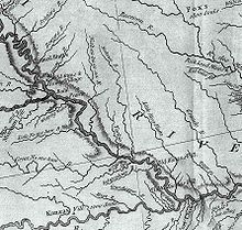
The Tarkio River (also known as the Big Tarkio River) is a non-navigable river that stretches for approximately 140 miles (225 km)[1] from Cass County, Iowa to its mouth on the Missouri River in Holt County, Missouri.[2]
The river basin which drains approximately 508 square miles (1,316 km2)[3] is sandwiched between the Nishnabotna River to the west and the Nodaway River to the east.
The name "Tarkio" is from a Native American word meaning "place where walnuts grow".[4][5]
The river passes rural areas and figures most prominently in the drainage system nears its mouth in management of Big Lake, Missouri and the Loess Bluffs National Wildlife Refuge, formerly known as Squaw Creek National Wildlife Refuge. Several streams and ditches in the Missouri River bottoms near its mouth contain the Tarkio name.
- ^ Lippincott's New Gazetteer: A Complete Pronouncing Gazetteer Or Geographical Dictionary of the World, Containing the Most Recent and Authentic Information Respecting the Countries, Cities, Towns ... in Every Portion of the Globe. J.B. Lippincott Company. 1906. p. 1807.
- ^ U.S. Geological Survey Geographic Names Information System: Tarkio River
- ^ Water-supply Paper. U.S. Government Printing Office. 1920. p. 1.
- ^ "History/Tarkio". Atchison County Development Corp. Retrieved 2009-03-07.
- ^ Broerman, Harry. "14 Suggested Options for Exploring the Merits of Atchison County". Atchison County. Retrieved 16 July 2011.
© MMXXIII Rich X Search. We shall prevail. All rights reserved. Rich X Search
