| Taum Sauk Mountain State Park | |
|---|---|
 The highest point in Missouri: Taum Sauk summit | |
| Location | Iron and Reynolds counties, Missouri, United States |
| Coordinates | 37°34′17″N 90°43′45″W / 37.57139°N 90.72917°W[1] |
| Area | 8,732.23 acres (35.3381 km2)[2] |
| Elevation | 1,772 ft (540 m)[1] |
| Designation | Missouri state park |
| Established | 1991[3] |
| Visitors | 144,160 (in 2017)[2] |
| Administrator | Missouri Department of Natural Resources |
| Website | Taum Sauk Mountain State Park |
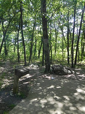
Taum Sauk Mountain State Park is a Missouri state park located in the St. Francois Mountains in the Ozarks. The park encompasses Taum Sauk Mountain, the highest point in the state.[4] The Taum Sauk portion of the Ozark Trail connects the park with nearby Johnson's Shut-ins State Park[5] and the Bell Mountain Wilderness Area, which together are part of a large wilderness area popular with hikers and backpackers.
In 2005, the Taum Sauk Hydroelectric Power Station was damaged and a billion gallons of water flooded parts of the park and other nearby areas.[6]
- ^ a b "Taum Sauk Mountain". Geographic Names Information System. United States Geological Survey, United States Department of the Interior.
- ^ a b Cite error: The named reference
parkdatawas invoked but never defined (see the help page). - ^ Cite error: The named reference
acquisitionwas invoked but never defined (see the help page). - ^ Cite error: The named reference
parkswas invoked but never defined (see the help page). - ^ Cite error: The named reference
associationwas invoked but never defined (see the help page). - ^ 10 years since Taum Sauk dam gave way
© MMXXIII Rich X Search. We shall prevail. All rights reserved. Rich X Search


