Back ت ویلئیجس، فلوریدا AZB The Villages Catalan Те-Вилледжес (Флорида) CE The Villages CEB The Villages German The Villages (Florida) Spanish The Villages Estonian ده ویلجز، فلوریدا Persian The Villages (Florida) Finnish The Villages French
The Villages | |
|---|---|
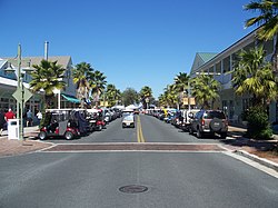
 Sumter Landing in The Villages | |
| Nickname(s): Florida's Friendliest Hometown, Boomer Paradise | |
 Interactive map of The Villages | |
| Coordinates: 28°54′12″N 81°59′19″W / 28.90333°N 81.98861°W[1] | |
| Country | United States |
| State | Florida |
| County | Sumter, Marion, Lake |
| Area | |
• Total | 33.95 sq mi (87.94 km2) |
| • Land | 32.65 sq mi (84.57 km2) |
| • Water | 1.30 sq mi (3.37 km2) |
| Elevation | 52 ft (16 m) |
| Population | |
• Total | 79,077 |
| • Density | 2,421.89/sq mi (935.08/km2) |
| Demonym | Villager |
| Time zone | UTC-5 (EST) |
| • Summer (DST) | UTC-4 (EDT) |
| ZIP code(s) | 32159, 32162, 32163, 34731, 34785, 34762 |
| Area code | 352 |
| FIPS code | 12-71625[4] |
| GNIS feature ID | 2402925[1] |
| Website | thevillages |
The Villages is a census-designated place (CDP) in Sumter, Marion, and Lake counties in the U.S. state of Florida. It forms the core of a broader master-planned, age-restricted community of the same name. Located in central Florida, approximately 20 miles (32 km) south of Ocala and 45 miles (72 km) northwest of Orlando, the CDP had a population of 79,077 at the 2020 United States census.[3] The Villages is known for its extensive amenities, including golf courses and recreation centers, and is part of the Orlando–Kissimmee–Sanford metropolitan statistical area.
- ^ a b c U.S. Geological Survey Geographic Names Information System: The Villages, Florida
- ^ "2020 U.S. Gazetteer Files: Florida". United States Census Bureau. Retrieved December 2, 2021.
- ^ a b "P1. Race – The Villages CDP, Florida: 2020 DEC Redistricting Data (PL 94-171)". U.S. Census Bureau. Retrieved December 21, 2022.
- ^ "U.S. Census website". United States Census Bureau. Retrieved May 23, 2015.
© MMXXIII Rich X Search. We shall prevail. All rights reserved. Rich X Search