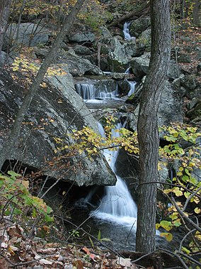
| Three Ridges Wilderness | |
|---|---|
 | |
| Location | Nelson, Virginia, United States |
| Coordinates | 37°51′52″N 78°59′07″W / 37.86444°N 78.98528°W |
| Area | 4,702 acres (19.03 km2)[1] |
| Elevation | 3,400 ft (1,000 m) |
| Established | 2000 |
| Operator | George Washington and Jefferson National Forests |
| Website | George Washington and Jefferson National Forests – Three Ridges Wilderness Area |
Three Ridges Wilderness is a U.S. Wilderness Area in the Glenwood/Pedlar Ranger District of the George Washington and Jefferson National Forests. The wilderness area is located just east of the Blue Ridge Parkway between the Tye River and Wintergreen Ski Resort.
It is separated from the boundary of the Priest Wilderness by Virginia State Route 56. The wilderness consists of 4,702 acres (19.03 km2) and ranges in elevation from 1,000 feet (305 m) at the Tye River to 3,970 feet (1,210 m) at the summit of Three Ridges Mountain.
© MMXXIII Rich X Search. We shall prevail. All rights reserved. Rich X Search

