Back غابة تورينغن Arabic غابة تورينجن ARZ Türingen Meşəsi Azerbaijani Цюрынгенскі Лес Byelorussian Тюрингер Валд Bulgarian Thüringer Wald CEB Durynský les Czech Thüringer Wald Danish Thüringer Wald German Turingia Arbaro Esperanto
| Thuringian Forest | |
|---|---|
| Thüringer Wald | |
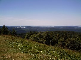
 View from Schneekopf towards Oberhof | |
| Highest point | |
| Peak | Großer Beerberg |
| Elevation | 983 m (3,225 ft) |
| Coordinates | 50°39′34″N 10°44′42″E / 50.65944°N 10.74500°E |
| Geography | |
| Country | Germany |
| Region | Thuringia |
| Range coordinates | 50°40′N 10°45′E / 50.667°N 10.750°E |
| Geology | |
| Orogeny | Variscan, Saxonian |
| Age of rock | Paleozoic |
| Type of rock | sedimentary, metamorphic, magmatic |
The Thuringian Forest[1][2] (Thüringer Wald in German pronounced [ˈtyːʁɪŋɐ ˈvalt] ) is a mountain range in the southern parts of the German state of Thuringia, running northwest to southeast. Skirting from its southerly source in foothills to a gorge on its north-west side is the Werra valley. On the other side of the Forest is an upper outcrop of the North German Plain, the Thuringian Basin, which includes the city Erfurt. The south and south-east continuation of the range is the highland often called the Thuringian-Vogtlandian Slate Mountains.[a]
Among scattered foothills at its northern foot are the towns Eisenach, Gotha, Arnstadt and Ilmenau. The town of Suhl sits in a slight dip on the range itself.
In October 1806, Napoleon Bonaparte invaded Saxony with his "Grande Armée," fighting the Battle of Jena–Auerstedt near the wood. This battle, part of the War of the Fourth Coalition, is generally regarded as the basis of Napoleon's success over the Alliance.
- ^ Elkins, T H (1972). Germany (3rd ed.). London: Chatto & Windus, p. 288-9. ISBN 9780701106515.
- ^ Kohl, Horst; Marcinek, Joachim and Nitz, Bernhard (1986). Geography of the German Democratic Republic, VEB Hermann Haack, Gotha, p. 7 ff. ISBN 978-3-7301-0522-1.
Cite error: There are <ref group=lower-alpha> tags or {{efn}} templates on this page, but the references will not show without a {{reflist|group=lower-alpha}} template or {{notelist}} template (see the help page).
© MMXXIII Rich X Search. We shall prevail. All rights reserved. Rich X Search
