Toowoomba Bypass | |
|---|---|
 | |
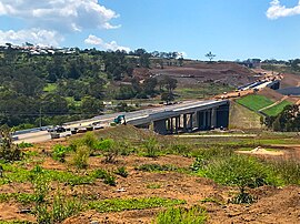
| Toowoomba Bypass during construction, looking east from Cranley. | |
 | |
| General information | |
| Type | Highway |
| Length | 41.3 km (26 mi) |
| Opened | 8 September 2019 |
| Route number(s) |
|
| Ring road around | Toowoomba |
| Major junctions | |
| Northeast end | |
| |
| Southwest end | |
| Location(s) | |
| Major settlements | Postmans Ridge, Withcott, Mount Kynoch, Cranley, Charlton, Wellcamp, Athol |
| Highway system | |
| ---- | |
The Toowoomba Bypass, known as Toowoomba Second Range Crossing during planning and construction, is a 41.3 km (25.7 mi) grade separated, dual carriageway bypass and partial ring road constructed to the north and west of Toowoomba, Queensland.[1] Construction commenced in April 2016. It opened to traffic on 8 September 2019.
The Toowoomba Bypass is a toll road. It is the only toll road in Australia that is not located in Greater Sydney, Greater Melbourne, or Greater Brisbane, and the only one that does not pass through a capital city, and one of only 10 located outside New South Wales.
Cite error: There are <ref group=lower-alpha> tags or {{efn}} templates on this page, but the references will not show without a {{reflist|group=lower-alpha}} template or {{notelist}} template (see the help page).
- ^ Department of Transport and Main Roads (5 August 2019). "Toowoomba Second Range Crossing". tmr.qld.gov.au. Queensland. Retrieved 13 August 2019.
© MMXXIII Rich X Search. We shall prevail. All rights reserved. Rich X Search
