Back Тотън (ледник) Bulgarian Totten Glacier CEB Totten-Gletscher German Glacier Totten French קרחון טוטן HE Ghiacciaio Totten Italian Тотенов Ледник Macedonian Tottenbreen NN Ледник Тоттена Russian Totten Glacier Swedish
| Totten Glacier | |
|---|---|
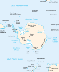
 Map of Antarctica, with Wilkes Land slightly to the right | |
Location of Totten Glacier in Antarctica | |
| Location | Wilkes Land |
| Coordinates | 67°00′00″S 116°20′00″E / 67.00000°S 116.33333°E |
Totten Glacier is a large glacier draining a major portion of the East Antarctic Ice Sheet, through the Budd Coast of Wilkes Land in the Australian Antarctic Territory. The catchment drained by the glacier is estimated at 538,000 km2 (208,000 sq mi),[1] extending approximately 1,100 km (680 mi) into the interior and holds the potential to raise sea level by at least 3.5 m (11 ft).[2] Totten drains northeastward from the continental ice but turns northwestward at the coast where it terminates in a prominent tongue close east of Cape Waldron. It was first delineated from aerial photographs taken by USN Operation Highjump (1946–47), and named by Advisory Committee on Antarctic Names (US-ACAN) for George M. Totten, midshipman on USS Vincennes of the United States Exploring Expedition (1838–42), who assisted Lieutenant Charles Wilkes with correction of the survey data obtained by the expedition.
Totten Ice Shelf is a 6,200 km2 (2,400 sq mi) floating portion of Totten Glacier, laterally bounded by the Aurora Subglacial Basin to the south and Law Dome to the north. The ice shelf exists at the confluence of the two main grounded tributaries of Totten Glacier, its base lies 2,500 m (8,200 ft) below sea level near the grounding line of the western tributary, and the ice shelf surface is characterized by longitudinal channels and transverse fractures.[3][4] Totten Ice Shelf is of glaciological interest because it buttresses the flow of grounded ice while coupling the ice basin to ocean processes such as ocean warming.[5][6]
Totten Glacier Tongue (66°35′S 116°5′E / 66.583°S 116.083°E) is a small glacier tongue extending seaward from Totten Glacier. Delineated from air photos taken by U.S. Navy Operation Highjump (1946–47) and named by US-ACAN in association with Totten Glacier.
- ^ Roberts, Jason; et al. (2011). "Refined broad-scale sub-glacial morphology of Aurora Subglacial Basin and East Antarctica derived by an ice-dynamics-based interpolation scheme". The Cryosphere. 5 (3): 551–560. Bibcode:2011TCry....5..551R. doi:10.5194/tc-5-551-2011. hdl:2152/41173.
- ^ Greenbaum, J. S.; Blankenship, D. D.; Young, D. A.; Richter, T. G.; Roberts, J. L.; Aitken, A. R. A.; Legresy, B.; Schroeder, D. M.; Warner, R. C. (2015). "Ocean access to a cavity beneath Totten Glacier in East Antarctica". Nature Geoscience. 8 (4): 294–298. Bibcode:2015NatGe...8..294G. doi:10.1038/ngeo2388. ISSN 1752-0908.
- ^ Greene, C. A.; Blankenship, D. D. (2018). "A Method of Repeat Photoclinometry for Detecting Kilometer-Scale Ice Sheet Surface Evolution". IEEE Transactions on Geoscience and Remote Sensing. 56 (4): 2074–2082. Bibcode:2018ITGRS..56.2074G. doi:10.1109/TGRS.2017.2773364. ISSN 0196-2892. S2CID 4348022.
- ^ Dow, Christine F.; Lee, Won Sang; Greenbaum, Jamin S.; Greene, Chad A.; Blankenship, Donald D.; Poinar, Kristin; Forrest, Alexander L.; Young, Duncan A.; Zappa, Christopher J. (2018-06-01). "Basal channels drive active surface hydrology and transverse ice shelf fracture". Science Advances. 4 (6): eaao7212. Bibcode:2018SciA....4.7212D. doi:10.1126/sciadv.aao7212. ISSN 2375-2548. PMC 6007161. PMID 29928691.
- ^ Cite error: The named reference
:4was invoked but never defined (see the help page). - ^ Greene, Chad A.; Young, Duncan A.; Gwyther, David E.; Galton-Fenzi, Benjamin K.; Blankenship, Donald D. (2018-09-06). "Seasonal dynamics of Totten Ice Shelf controlled by sea ice buttressing". The Cryosphere. 12 (9): 2869–2882. Bibcode:2018TCry...12.2869G. doi:10.5194/tc-12-2869-2018. ISSN 1994-0416.
© MMXXIII Rich X Search. We shall prevail. All rights reserved. Rich X Search
