Back تونجوراهوا ARZ Tunquraua Azerbaijani Тунгурауа Bulgarian Tungurahua Catalan Tungurahua (bolkan sa Igwador) CEB Tungurahua (sopka) Czech Tungurahua German Τουνγκουράουα Greek Tungurahua (vulkano) Esperanto Volcán Tungurahua Spanish
This article needs to be updated. (October 2020) |
| Tungurahua | |
|---|---|
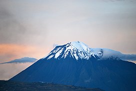
 View from Riobamba (September 2011) | |
| Highest point | |
| Elevation | 5,023 m (16,480 ft)[1] |
| Prominence | 1,554 m (5,098 ft) |
| Listing | Ultra |
| Coordinates | 1°28′12″S 78°26′41″W / 1.4700°S 78.4447°W[2] |
| Naming | |
| English translation | Throat of fire |
| Language of name | Quechua |
| Geography | |
| Location | Ecuador |
| Parent range | Cordillera Oriental, Andes |
| Topo map | IGM, CT-ÑIV-D1[3] |
| Geology | |
| Age of rock | Holocene (Gomez 1994) |
| Mountain type | Stratovolcano (active) |
| Volcanic arc/belt | Northern Volcanic Zone |
| Last eruption | 2000 to 2017[4] |
| Climbing | |
| First ascent | 1873 by Alphons Stübel and Wilhelm Reiss |
| Easiest route | Scrambling/Snow/Ice PD |

Tungurahua (/tʊŋɡʊˈrɑːwə/; from Quichua tunguri (throat) and rahua (fire), "Throat of Fire")[5] is an active stratovolcano located in the Cordillera Oriental of Ecuador. The volcano gives its name to the province of Tungurahua. Volcanic activity restarted on August 19, 1999,[6] and is ongoing as of 2023[update], with several eruptive episodes since then, the most recent lasting from February 26 to March 16, 2016.[7]
- ^ Several elevation data between 5,016 and 5,029 m are used, 5,023 m is the one used on IGM maps. Used extremes are: 5,087 m (Stübel 1897) and 5,005 m (Neate 1994).
- ^ "Tungurahua". Global Volcanism Program. Smithsonian Institution. Retrieved 2009-01-01.
- ^ IGM (Instituto Geografico Militar, Ecuador) (1989). "Baños Ecuador, CT-ÑIV-D1". Archived from the original on 2008-12-19. Retrieved 2008-01-26.
- ^ "Tungurahua volcano". 19 Feb 2018.
- ^ "In the shadow of the Tungurahua volcano". BBC News. 7 September 2006.)
- ^ "Tungurahua volcano erupts in Ecuador". NBC News. 19 Aug 2012.
- ^ "Global Volcanism Program". National Museum of Natural History. Smithsonian Institution. Retrieved 2023-11-25.
© MMXXIII Rich X Search. We shall prevail. All rights reserved. Rich X Search