Back উদয়পুর (ত্রিপুরা) Bengali/Bangla Udaipur (Tripura) Catalan Udaipur (lungsod sa Indiya, Tripura) CEB Udaipur (Tripura) Spanish اودایپور، تریپورا Persian Udaipur (Tripura) Finnish उदयपुर, त्रिपुरा Hindi Udaipur (Tripura) Italian उदयपूर (त्रिपुरा) Marathi Udaipur (Tripura) Dutch
Udaipur | |
|---|---|
Town | |
| Udaipur | |
 | |
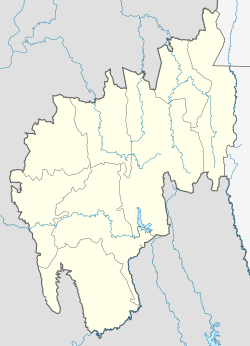
| Coordinates: 23°32′20″N 91°29′30″E / 23.53889°N 91.49167°E | |
| Country | |
| State | Tripura |
| District | Gomati district |
| Named for | Udai Manikya |
| Government | |
| • Type | Municipal Council |
| • Body | Udaipur Municipal Council |
| • Chairman | Sital Chandra Majumdar (BJP) |
| Elevation | 22 m (72 ft) |
| Population (2011)[1] | |
| • Total | 32,758 |
| • Rank | 3rd (in Tripura) |
| Languages | |
| • Official | Bengali, Kokborok, English[2] |
| Time zone | UTC+5:30 (IST) |
| Vehicle registration | TR-03 |
| Website | gomati |
Udaipur (/ˈuːdaɪˌpʊə/), formerly known as Rangamati, is the third biggest urban area in the Indian state of Tripura. The town was a capital of the state during the reign of the Manikya Dynasty. It is famous for the Tripura Sundari temple also known as Tripureswari temple, one of the 51 Shakti Peethas.[3] It is a Municipal Council in Gomati district & also the headquarter of Gomati district. Udaipur is about 51 km from Agartala, the capital of Tripura.
- ^ Cite error: The named reference
Censuswas invoked but never defined (see the help page). - ^ "Report of the Commissioner for linguistic minorities: 52nd report (July 2014 to June 2015)" (PDF). Commissioner for Linguistic Minorities, Ministry of Minority Affairs, Government of India. pp. 79–84. Archived from the original (PDF) on 15 November 2016. Retrieved 16 February 2016.
- ^ "Tripura Sundari Temple gets a Deepavali makeover as govt slams Left front for neglecting shrines". The Indian Express. 7 November 2018.
© MMXXIII Rich X Search. We shall prevail. All rights reserved. Rich X Search

