Back منطقة اوتراكشي Arabic اوتراكشى ARZ উত্তৰকাশী জিলা Assamese उत्तरकाशी जिला Bihari উত্তরকাশী জেলা Bengali/Bangla Uttarkāshi (distrito) CEB Uttarkashi (Distrikt) German Distrito de Uttarkashi Spanish Uttarkashi barrutia Basque بخش اترکاشی Persian
Uttarkashi district | |
|---|---|
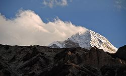
Clockwise from top-left: Gaumukh, view from Dayara Bugyal, Hills near Kedarkantha, Peaks in Gangotri National Park, Kashi Vishwanath Temple in Uttarkashi | |
| Nickname: uki | |
 Location in Uttarakhand | |
| Coordinates: 30°44′N 78°27′E / 30.73°N 78.45°E | |
| Country | |
| State | Uttarakhand |
| Division | Garhwal |
| Headquarters | Uttarkashi |
| Government | |
| • District collector | Abhishek Ruhela IAS[1] |
| Area | |
| • Total | 8,016 km2 (3,095 sq mi) |
| Population | |
| • Total | 330,086 |
| • Density | 41/km2 (110/sq mi) |
| Languages | |
| • Native | Garhwali, Jad |
| • Official | Hindi, Sanskrit |
| Time zone | UTC+5:30 (IST) |
| Vehicle registration | UK-10 |
| Website | uttarkashi |
Uttarkashi District is a district of Garhwal division of the Uttarakhand state in northern India, and has its headquarters at Uttarkashi city. It has six Tehsils namely Barkot, Dunda, Bhatwadi, Chinyalisaur, Purola and Mori.
The district contains the source of the Bhagirathi (traditionally considered the headstream of the Ganga) at Gangotri and Yamuna at Yamunotri, both of which are highly significant and popular pilgrimage sites. Uttarkashi town, which lies on the main road to Gangotri, is also considered an important Hindu pilgrimage centre, especially for Saivites. The district is bounded on the north by Kinnaur and Shimla districts of Himachal Pradesh, on the northeast by Tibet, China, on the east by Chamoli District, on the southeast by Rudraprayag district, on the south by Tehri Garhwal district, and on the west by Dehradun district.
- ^ "Who's Who | Uttarkashi | India". Retrieved 29 July 2022.
© MMXXIII Rich X Search. We shall prevail. All rights reserved. Rich X Search


