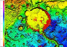
A viewshed is the geographical area that is visible from a location. It includes all surrounding points that are in line-of-sight with that location and excludes points that are beyond the horizon or obstructed by terrain and other features (e.g., buildings, trees). Conversely, it can also refer to area from which an object can be seen.[1] A viewshed is not necessarily "visible" to humans; the same concept is used in radio communications to indicate where a specific combination of transmitter, antenna, and terrain allow reception of signal.
Viewsheds are commonly used in terrain analysis, which is of interest to urban planning, archaeology, and military science. In urban planning, for example, viewsheds tend to be calculated for areas of particular scenic or historic value that are deemed worthy of preservation against development or other change. Viewsheds are often calculated for public areas — for example, from public roadways, public parks, or high-rise buildings. The preservation of viewsheds is frequently a goal in the designation of open space areas, green belts, and community separators.
© MMXXIII Rich X Search. We shall prevail. All rights reserved. Rich X Search
