Back منطقة وارذا Arabic وارذا ARZ वर्धा जिला Bihari ওয়ার্ধা জেলা Bengali/Bangla Districte de Wardha Catalan Wardha (distrito) CEB Wardha (Distrikt) German Distrito de Wardha Spanish Wardha barrutia Basque بخش ورده Persian
Wardha District | |
|---|---|
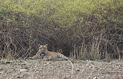
Clockwise from top-left: Hut at Bapu Kuti in Sevagram, Tomb in Paunar Fort, Panchadhara Temple, Tiger in Bor Wildlife Sanctuary, Vishwa Shanti Stupa in Wardha | |
 Location in Maharashtra | |
| Country | |
| State | Maharashtra |
| Division | Nagpur |
| Headquarters | Wardha |
| Tehsils | 1. Wardha, 2. Deoli, 3. Seloo, 4. Arvi 5. Ashti 6. Karanja 7. Hinganghat, 8. Samudrapur. |
| Government | |
| • Body | Wardha Zilla Parishad |
| • Guardian Minister | Sudhir Mungantiwar Cabinet Minister |
| • President Zilla Parishad |
|
| • District Collector |
|
| • CEO Zilla Parishad |
|
| • MPs | |
| Area | |
| • Total | 6,310 km2 (2,440 sq mi) |
| Population (2011) | |
| • Total | 1,300,774 |
| • Density | 210/km2 (530/sq mi) |
| Demographics | |
| • Literacy | 86.99% |
| • Sex ratio | 946:1000 (Female:Male) |
| Time zone | UTC+05:30 (IST) |
| Major highways | NH7(Hinganghat) |
| Average annual precipitation | 1062.8 mm |
| Website | wardha |
Wardha District (Marathi pronunciation: [ʋəɾd̪ʰaː]) is in the state of Maharashtra in western India. This district is a part of Nagpur Division. The city of Wardha is the administrative headquarter of the district. Hinganghat, Pulgaon, Arvi and Wardha are the major cities in the District. The District had a population of 1,300,774, of which 26.28% were urban as of 2011.
© MMXXIII Rich X Search. We shall prevail. All rights reserved. Rich X Search


