Back واردنير (أيداهو) Arabic واردنير ARZ واردنر، آیداهو AZB Уорднър Bulgarian Wardner Catalan Варднер (Айдахо) CE Wardner CEB Wardner, Idaho Welsh Wardner (Idaho) Spanish Wardner (Idaho) Basque
Wardner, Idaho | |
|---|---|
![Wardner in 1904 (foreground), separated from Kellogg (middle ground), by the conical hill called Haystack Peak[1]](http://upload.wikimedia.org/wikipedia/commons/thumb/b/b7/Wardner%26Kellog.jpg/250px-Wardner%26Kellog.jpg) Wardner in 1904 (foreground), separated from Kellogg (middle ground), by the conical hill called Haystack Peak[1] | |
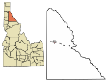
 Location of Wardner in Shoshone County, Idaho. | |
| Coordinates: 47°31′23″N 116°8′3″W / 47.52306°N 116.13417°W | |
| Country | United States |
| State | Idaho |
| County | Shoshone |
| Government | |
| • Mayor | Jo Ann Groves |
| Area | |
| • Total | 0.87 sq mi (2.26 km2) |
| • Land | 0.87 sq mi (2.26 km2) |
| • Water | 0.00 sq mi (0.00 km2) |
| Elevation | 2,657 ft (810 m) |
| Population | |
| • Total | 188 |
| • Estimate (2019)[4] | 176 |
| • Density | 201.83/sq mi (77.95/km2) |
| Time zone | UTC-8 (Pacific (PST)) |
| • Summer (DST) | UTC-7 (PDT) |
| ZIP code | 83837 |
| Area code(s) | 208, 986 |
| FIPS code | 16-85240 |
| GNIS feature ID | 0400161 |
| Website | www |
Wardner is a city in Shoshone County, Idaho, United States. Located in the Silver Valley mining region, the population was 188 at the 2010 census, down from 215 in 2000.
- ^ Ransome, Frederick; Calkins, Frank (1908). The geology and ore deposits of the Coeur d'Alene district, Idaho, USGS Professional Paper 62. Washington: U.S. Dept. of the Interior, USGS, Government Printing Office. p. 22. doi:10.3133/pp62. Retrieved November 21, 2018.
- ^ "2019 U.S. Gazetteer Files". United States Census Bureau. Retrieved July 9, 2020.
- ^ Cite error: The named reference
wwwcensusgovwas invoked but never defined (see the help page). - ^ Cite error: The named reference
USCensusEst2019CenPopScriptOnlyDirtyFixDoNotUsewas invoked but never defined (see the help page).
© MMXXIII Rich X Search. We shall prevail. All rights reserved. Rich X Search