Back ويست لين Arabic وست لین، اورقن AZB Западен Лин (град, Орегон) Bulgarian West Linn Catalan Вест-Линн (Орегон) CE West Linn CEB West Linn, Oregon Welsh West Linn German West Linn Spanish West Linn (Oregon) Basque
West Linn | |
|---|---|
City | |
| West Linn, Oregon | |
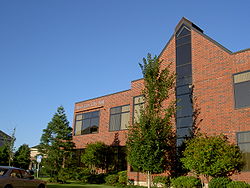
 West Linn City Hall | |
| Motto(s): City of Hills, Trees and Rivers | |
 Location in Oregon | |
| Coordinates: 45°21′55″N 122°38′28″W / 45.36528°N 122.64111°W | |
| Country | United States |
| State | Oregon |
| County | Clackamas |
| Incorporated | 1913 |
| Named for | Lewis F. Linn |
| Government | |
| • Type | Mayor–council government |
| • Mayor | Rory Bialostosky[1] |
| Area | |
| • Total | 8.11 sq mi (21.00 km2) |
| • Land | 7.43 sq mi (19.24 km2) |
| • Water | 0.68 sq mi (1.76 km2) |
| Elevation | 679 ft (207 m) |
| Population | |
| • Total | 27,373 |
| • Density | 3,684.12/sq mi (1,422.47/km2) |
| Time zone | UTC-8 (Pacific) |
| • Summer (DST) | UTC-7 (Pacific) |
| ZIP code | 97068 |
| Area code | 503 |
| FIPS code | 41-80150[5] |
| GNIS feature ID | 2412224[3] |
| Website | westlinnoregon.gov |
West Linn is a city in Clackamas County, Oregon, United States. A southern suburb within the Portland metropolitan area, West Linn developed on the site of the former Linn City, which was named after U.S. Senator Lewis F. Linn of Ste. Genevieve, Missouri, who had advocated the American occupation of the Oregon territory as a counterclaim to the British.
The Sullivan hydroelectric plant opened in 1889, and harvested energy from nearby Willamette Falls. The adjacent Willamette Falls Pulp and Paper Company began operations the same year.
As of the 2020 census, the city had a population of 27,373.
- ^ "City Council". City of West Linn. Retrieved April 25, 2023.
- ^ "ArcGIS REST Services Directory". United States Census Bureau. Retrieved October 12, 2022.
- ^ a b U.S. Geological Survey Geographic Names Information System: West Linn, Oregon
- ^ Cite error: The named reference
USCensusDecennial2020CenPopScriptOnlywas invoked but never defined (see the help page). - ^ "U.S. Census website". United States Census Bureau. Retrieved January 31, 2008.
© MMXXIII Rich X Search. We shall prevail. All rights reserved. Rich X Search

