Back White River (suba sa Kanada, Ontario, lat 48,55, long -86,27) CEB White River (Oberer See) German White River, Ontario (vattendrag) Swedish
| White River | |
|---|---|
 | |
| Location | |
| Country | Canada |
| Province | Ontario |
| Districts | Algoma, Thunder Bay |
| Physical characteristics | |
| Source | Negwazu Lake |
| • location | Unorg. North Algoma |
| • coordinates | 48°28′22″N 85°02′47″W / 48.47278°N 85.04639°W |
| • elevation | 415 m (1,363 ft)[1] |
| Mouth | Lake Superior |
• location | Pukaskwa National Park, Thunder Bay District |
• coordinates | 48°32′49″N 86°16′6″W / 48.54694°N 86.26833°W |
• elevation | 183 m (600 ft) |
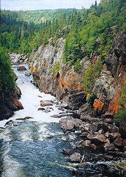
The White River (French: rivière White) is a tributary of Lake Superior in Thunder Bay District, Ontario, Canada.[2] It starts at Negwazu Lake and flows in a predominantly western direction to Lake Superior, passing through the Township of White River.
The White River has many stretches of whitewater and four waterfalls with some difficult portages, making the river suitable for advanced canoeists. The lower part of the river has occasional oxbows and meanders.[3] Among its tributaries are the Bremner,[4] Depew,[5] and Oskabukuta Rivers.[6] The river contains a diversity of fish species, including healthy walleye populations.[3]
- ^ White, James (1915). Altitudes in the Dominion of Canada (2nd ed.). Ottawa: Commission of Conservation. p. 6.
- ^ "White River". Geographical Names Data Base. Natural Resources Canada.
- ^ a b "White Lake Provincial Park Management Plan: Amendment". Ontario.ca. Ministry of the Environment, Conservation and Parks. 16 November 2015. Retrieved 21 October 2021.
- ^ "Bremner River". Geographical Names Data Base. Natural Resources Canada.
- ^ "Depew River". Geographical Names Data Base. Natural Resources Canada.
- ^ "Oskabukuta River". Geographical Names Data Base. Natural Resources Canada.
© MMXXIII Rich X Search. We shall prevail. All rights reserved. Rich X Search
