Back مقاطعة وود (ويسكونسن) Arabic Wood County, Wisconsin BAR Уд (окръг, Уисконсин) Bulgarian ৱড কাউন্টি, উইসকনসিন BPY Wood Gông (Wisconsin) CDO Вуд (гуо, Висконсин) CE Wood County (kondado sa Tinipong Bansa, Wisconsin) CEB Wood County (Wisconsin) Czech Wood County, Wisconsin Welsh Wood County (Wisconsin) German
Wood County | |
|---|---|
 Wood County Courthouse | |
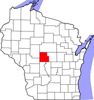
 Location within the U.S. state of Wisconsin | |
 Wisconsin's location within the U.S. | |
| Coordinates: 44°27′N 90°02′W / 44.45°N 90.04°W | |
| Country | |
| State | |
| Founded | 1856 |
| Named for | Joseph Wood |
| Seat | Wisconsin Rapids |
| Largest city | Marshfield |
| Area | |
| • Total | 809 sq mi (2,100 km2) |
| • Land | 793 sq mi (2,050 km2) |
| • Water | 16 sq mi (40 km2) 2.0% |
| Population | |
| • Total | 74,207 |
| • Estimate (2023) | 73,939 |
| • Density | 93.6/sq mi (36.1/km2) |
| Time zone | UTC−6 (Central) |
| • Summer (DST) | UTC−5 (CDT) |
| Congressional districts | 3rd, 7th |
| Website | www |
Wood County is a county located in the U.S. state of Wisconsin. As of the 2020 census, the population was 74,207.[1] Its county seat is Wisconsin Rapids.[2] The county is named after Joseph Wood, a member of the Wisconsin State Assembly.[3] Wood County comprises the Wisconsin Rapids-Marshfield, WI Micropolitan Statistical Area and is included in the Wausau-Stevens Point-Wisconsin Rapids, WI Combined Statistical Area.
- ^ a b Cite error: The named reference
2020-census-55141was invoked but never defined (see the help page). - ^ "Find a County". National Association of Counties. Retrieved June 7, 2011.
- ^ "Here's How Iron Got Its Name". The Rhinelander Daily News. June 16, 1932. p. 2. Retrieved August 24, 2014 – via Newspapers.com.

© MMXXIII Rich X Search. We shall prevail. All rights reserved. Rich X Search