Back Récif Zhongzhou French Karang Zhongzhou, Republik Tiongkok ID 中洲島 Japanese 중저우 암초 Korean Bàn Than Vietnamese 中洲礁 Chinese 中洲島 ZH-YUE
 Zhongzhou Reef | |
| Other names | Zhōngzhōu jiāo (中洲礁) (Chinese) Bãi Bàn Than (Vietnamese) |
|---|---|
| Geography | |
| Location | South China Sea |
| Coordinates | 10°23′10″N 114°24′49″E / 10.38611°N 114.41361°E |
| Archipelago | Spratly Islands |
| Administration | |
| Municipality | Cijin, Kaohsiung |
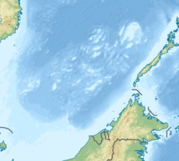
Zhongzhou Reef also known as Ban Than Reef and Centre Cay[3] (Mandarin Chinese: 中洲礁; pinyin: Zhōngzhōu Jiāo; Vietnamese: Bãi Bàn Than) is a small coral reef on the north edge of the Tizard Bank in the Spratly Islands, South China Sea under administration by the Republic of China (Taiwan). It lies 4.6 km (2.9 mi) east of Taiwan-administered Taiping Island (Itu Aba), 7.2 km (4.5 mi) west of Vietnam-administered Sand Cay,[4] and has an exposed area of approximately 0.2 hectares (0.49 acres) during high tide, and 0.6 hectares (1.5 acres) during low tide.[dubious – discuss][citation needed] It consists of an accumulation of seashells, sand, coral reefs and debris which forms a circular coral reef plate, surrounding the reef under the water, with a diameter of approximately 1.3 km (0.8 mi).[citation needed]
The reef is also claimed by the People's Republic of China, the Philippines, and Vietnam.
As many as 51 species of migratory birds inhabit the reef for short stays. The surrounding waters contain a rich marine ecosystem with plentiful staghorn coral. Shellfish species such as Harpago chiragra and Cassis cornuta can be found on the reef, and the surrounding waters contain various common tropical fish and coral reef fish. The reef geology is not suitable for plant growth.[citation needed]
The reef has no groundwater source. Though currently uninhabited by humans, the Taiwanese Coast Guard sends regular patrols via M8 speedboats from nearby Taiping Island. These patrols circle the reef, in addition to landing, making inspections and carrying out ecological surveys.[citation needed] The Vietnam People's Navy also sends patrols from nearby Sand Cay.
- ^ Hsiao, Anne Hsiu-An; Lin, Cheng-Yi (19 May 2017). The South China Sea Dispute. Cambridge University Press. pp. 74–103. ISBN 9789814695565. Retrieved 31 October 2021.
- ^ 繆, 宇綸. "我在南海佔領中洲礁 太平島官兵定期巡視". Yahoo News. 中國廣播公司. Retrieved 31 October 2021.
- ^ Itu Aba Island (Taiping Island), Spratly Islands, globalsecurity.org
- ^ measured at HERE Satellite Image Tiles
© MMXXIII Rich X Search. We shall prevail. All rights reserved. Rich X Search

