Zikrin
ذكرين Dhikerin[1] | |
|---|---|
 Façade of ruined house in Khirbet Dhikrin | |
| Etymology: Dhikerin el Baradan; Dhikerin the cool[2] | |
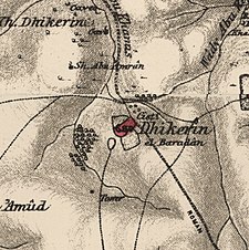
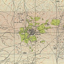
A series of historical maps of the area around Zikrin (click the buttons) | |
Location within Mandatory Palestine | |
| Coordinates: 31°39′48″N 34°51′38″E / 31.66333°N 34.86056°E | |
| Palestine grid | 136/119 |
| Geopolitical entity | Mandatory Palestine |
| Subdistrict | Hebron |
| Date of depopulation | 22–23 October 1948[5] |
| Area | |
| • Total | 17,195 dunams (17.195 km2 or 6.639 sq mi) |
| Population (1945) | |
| • Total | 960[3][4] |
| Cause(s) of depopulation | Military assault by Yishuv forces |
Zikrin (Arabic: ذكرين), pronounced Dhikrin, was a Palestinian Arab village in the Hebron Subdistrict, depopulated in the 1948 Palestine War. The site is located about 6 kilometres (3.7 mi) northwest of Beit Gubrin and sits at a mean elevation of 212 metres (696 ft) above sea-level, its access somewhat impeded by hedges of buckthorn and cactus. The entire site is dotted with grottoes and caves, and razed structures.
© MMXXIII Rich X Search. We shall prevail. All rights reserved. Rich X Search


