Back فرينتش (جزيره) ARZ French Island (pulo sa Ostralya) CEB French Island (Victoria) German French Island (Victoria) English جزیره فرانسوی (ویکتوریا) Persian French Island (Victoria) Italian French Island (Victoria) NB Ilha French (Victoria) Portuguese Френч (остров) Russian French Island (Victoria) SIMPLE
| French Island | |
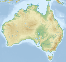
 Carte de French Island. | |
| Géographie | |
|---|---|
| Pays | |
| Localisation | Baie de Western Port (océan Indien) |
| Coordonnées | 38° 20′ 27″ S, 145° 28′ 03″ E |
| Superficie | 170 km2 |
| Point culminant | Mont Wellington (96 m) |
| Géologie | Île continentale |
| Administration | |
| État | Victoria |
| Démographie | |
| Population | 60 hab. (2007) |
| Densité | 0,35 hab./km2 |
| Autres informations | |
| Découverte | Préhistoire |
| Fuseau horaire | UTC+10 |
| Site officiel | frenchislandinfo.com |
| Îles en Australie | |
| modifier |
|
French Island (litt. « Île française ») est une île située dans la baie de Western Port, au sud de Melbourne ; c'est une zone non incorporée de l'État de Victoria en Australie.
© MMXXIII Rich X Search. We shall prevail. All rights reserved. Rich X Search

