Back Municipi Regional de Peel Catalan Peel (kondado) CEB Peel (Ontario) Czech Regional Municipality of Peel German Peela Regiono Esperanto Municipio Regional de Peel Spanish شهرستان پیل Persian Municipalité régionale de Peel French Municipalità Regionale di Peel Italian ピール地域 (オンタリオ州) Japanese
Peel Region | |
|---|---|
| Regional Municipality of Peel | |
Clockwise: Mississauga, Cheltenham Badlands, Chinguacousy Park, Brampton City Hall, view of Lake Ontario and Toronto from Jack Darling Memorial Park | |
| Motto: Working with you | |
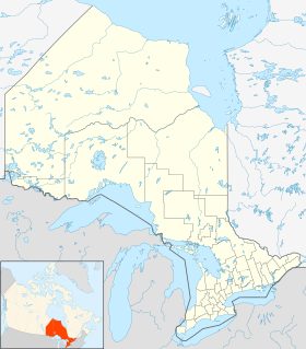
 Location in the Greater Toronto Area | |
| Coordinates: 43°45′10″N 79°47′33″W / 43.75278°N 79.79250°W | |
| Country | Canada |
| Province | Ontario |
| Established | January 1, 1974 |
| Seat | Brampton |
| Government | |
| • Chair | Nando Iannicca |
| • Governing body | Peel Regional Council |
| Area | |
| • Total | 1,246.95 km2 (481.45 sq mi) |
| Population | |
| • Total | 1,499,917 |
| • Estimate (Q4 2022)[3] | 1,516,019 |
| • Density | 1,108/km2 (2,870/sq mi) |
| Time zone | UTC-5 (Eastern (EST)) |
| • Summer (DST) | UTC-4 (Eastern (EDT)) |
| Website | peelregion.ca |

The Regional Municipality of Peel (informally Peel Region or Region of Peel, also formerly Peel County) is a regional municipality in the Greater Toronto Area, Southern Ontario, Canada. It consists of three municipalities to the west and northwest of the city of Toronto: the cities of Mississauga and Brampton, and the town of Caledon, each of which spans its full east–west width.[4] The regional seat is in Brampton.
With a population of about 1.5 million,[2] Peel Region's growth can be credited largely to immigration and transportation infrastructure: seven 400-series highways serve the region and most of Toronto Pearson International Airport is located within its boundaries.
Mississauga, which occupies the southernmost portion of the region with over 800,000 residents, is the largest in population in Peel Region and is overall the seventh-largest lower-tier municipality in Canada. It reaches from Lake Ontario north to near Highway 407. Brampton, a city with over 600,000 residents, is located in the centre of the region, while in the north lies the town of Caledon, which is by far the largest town in the area and the most sparsely populated part of the region.
- ^ "Regional Municipality of Peel (Code 3521) Census Profile". 2011 census. Government of Canada - Statistics Canada. Retrieved 2012-03-01.
- ^ a b 2016 Census
- ^ "Population Change - Economic Indicators - Region of Peel".
- ^ "Regional Municipality of Peel (scanned map)". Map 21-6 [Southern Ontario]. Survey and Mapping Branch, Ministry of Natural Resources, Government of Ontario Canada. 1980. Archived from the original on 2010-05-28. Retrieved 2010-02-01.
© MMXXIII Rich X Search. We shall prevail. All rights reserved. Rich X Search


