Western Connecticut Planning Region | |
|---|---|
Planning region | |
| Western Connecticut Council of Governments (WestCOG) | |
   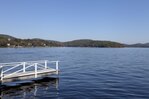  From top left: South Norwalk, Saugatuck River in Westport, Greenwich Point Beach, Candlewood Lake, Downtown Stamford | |
|
Logo | |
 Location within the U.S. state of Connecticut | |
 Connecticut's location within the U.S. | |
| Coordinates: 41°19′N 73°29′W / 41.31°N 73.48°W | |
| Country | |
| State | |
| Founded | 2013 |
| Largest city | Stamford |
| Other cities | Norwalk, Danbury |
| Government | |
| • Executive Director | Francis Pickering |
| Area | |
| • Total | 532.1 sq mi (1,378 km2) |
| Population (2020) | |
| • Total | 620,549 |
| Time zone | UTC−5 (Eastern) |
| • Summer (DST) | UTC−4 (EDT) |
| Congressional districts | 4th, 5th |
| Website | westcog |

Interactive map of the Western Connecticut Planning Region
The Western Connecticut Planning Region is a planning region and county-equivalent in Connecticut. It is served by the coterminous Western Connecticut Council of Governments (WestCOG), one of nine regional councils of governments in Connecticut. Within the region, there are two Metropolitan Planning Organizations, South Western CT MPO and the Housatonic Valley MPO.
The region includes the Connecticut Panhandle, Greater Danbury, and the Gold Coast. In 2022, planning regions were approved to replace Connecticut's counties as county-equivalents for statistical purposes, with full implementation occurring by 2024.[1][2]
- ^ "Governor Lamont Announces U.S. Census Bureau Approves Proposal for Connecticut's Planning Regions To Become County Equivalents". CT.gov. Retrieved March 24, 2023.
- ^ "Change to County-Equivalents in the State of Connecticut". Federal Register. June 6, 2022. Retrieved March 24, 2023.
© MMXXIII Rich X Search. We shall prevail. All rights reserved. Rich X Search