Back Geografie van Denemarke Afrikaans جغرافية الدنمارك ARZ Xeografía de Dinamarca AST Danimarka coğrafiyası Azerbaijani ডেনমার্কের ভূগোল Bengali/Bangla Danmarks geografi Danish Γεωγραφία της Δανίας Greek Geografía de Dinamarca Spanish جغرافیای دانمارک Persian Tanskan maantiede Finnish
 | |
| Continent | Europe |
|---|---|
| Region | Northern Europe (Scandinavia) |
| Coordinates | 56°00′N 10°00′E / 56.000°N 10.000°E |
| Area | |
| • Total | 43,094 km2 (16,639 sq mi) |
| • Land | 98% |
| • Water | 2% |
| Coastline | 8,750 km (5,440 mi) |
| Borders | Total land borders: 68 km |
| Highest point | Møllehøj 171 m |
| Lowest point | Lammefjord -7 m |
| Longest river | Gudenå 149 km |
| Largest lake | Arresø 40.72 km2 |
| Exclusive economic zone | 105,989 km2 (40,923 sq mi) (excludes the Faroe Islands and Greenland) |
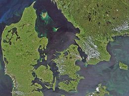
Denmark is a Nordic country located in Northern Europe. It consists of the Jutland Peninsula and several islands in the Baltic Sea, referred[citation needed] to as the Danish Archipelago. Denmark is located southwest of Sweden and due south of Norway and is bordered by the German state (and former possession) Schleswig-Holstein to the south, on Denmark's only land border, 68 kilometres (42 miles) long.
Denmark borders both the Baltic and North seas along its 8,750 km (5,440 mi) tidal shoreline. Denmark's general coastline is much shorter, at 1,701 km (1,057 mi), as it would not include most of the 1,419 offshore islands (each defined as exceeding 100 square metres in area) and the 180-kilometre long Limfjorden, which separates Denmark's second largest island, North Jutlandic Island, 4,686 km2 in size, from the rest of Jutland. No location in Denmark is further from the coast than 52 km (32 mi). The land area of Denmark is estimated to be 43,094 km2 (16,639 sq mi). However, it cannot be stated exactly since the ocean constantly erodes and adds material to the coastline, and there are human land reclamation projects. On the southwest coast of Jutland, the tide is between 1 and 2 m (3.28 and 6.56 ft), and the tideline moves outward and inward on a 10 km (6.2 mi) stretch.[1] A recent global remote sensing analysis suggested that there were 607 km2 of tidal flats in Denmark, making it the 42nd ranked country in terms of tidal flat extent.[2] Denmark has an Exclusive Economic Zone of 105,989 km2 (40,923 sq mi). When including the Faroe Islands and Greenland, the EEZ is the 15th largest in the world with 2,220,093 km2 (857,183 sq mi).
A circle enclosing the same total area as Denmark would have a diameter of 234 km (146 miles). Denmark has 443 named islands (1,419 islands above 100 m2),[3] of which 72 are inhabited (as of 1 January 2007[update], Statistics Denmark). The largest islands are Zealand (Sjælland) and Funen (Fyn). The island of Bornholm is located east of the rest of the country, in the Baltic Sea. Many of the larger islands are connected by bridges; the Øresund Bridge connects Zealand with Sweden; the Great Belt Bridge connects Funen with Zealand; and the Little Belt Bridge connects Jutland with Funen. Ferries or small aircraft connect to the smaller islands. Main cities are the capital Copenhagen on Zealand; Århus, Aalborg and Esbjerg in Jutland; and Odense on Funen.
Denmark experiences a temperate climate, with mild, windy winters and cool summers. The local terrain is generally flat with a few gently rolling plains. The territory of Denmark includes the island of Bornholm in the Baltic Sea and the rest of metropolitan Denmark, but excludes the Faroe Islands and Greenland. Its position gives Denmark complete control of the Danish Straits (Skagerrak and Kattegat) linking the Baltic and North Seas. The country's natural resources include petroleum, natural gas, fish, salt, limestone, chalk, stone, gravel, and sand.
- ^ Nationalencyklopedin, (1990)
- ^ Murray, N.J.; Phinn, S.R.; DeWitt, M.; Ferrari, R.; Johnston, R.; Lyons, M.B.; Clinton, N.; Thau, D.; Fuller, R.A. (2019). "The global distribution and trajectory of tidal flats". Nature. 565 (7738): 222–225. doi:10.1038/s41586-018-0805-8. PMID 30568300. S2CID 256767470.
- ^ Islands in total and named islands[permanent dead link]
© MMXXIII Rich X Search. We shall prevail. All rights reserved. Rich X Search