'Ajjur
عجّور 'Ajur | |
|---|---|
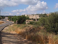
 House in 'Ajjur | |
| Etymology: Furrows on the sand made by the wind[1] | |
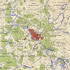
A series of historical maps of the area around 'Ajjur (click the buttons) | |
Location within Mandatory Palestine | |
| Coordinates: 31°41′22″N 34°55′22″E / 31.68944°N 34.92278°E | |
| Palestine grid | 142/121 |
| Geopolitical entity | Mandatory Palestine |
| Subdistrict | Hebron |
| Date of depopulation | 23–24 July 1948[2] primary, 23 October 1948[3] secondary |
| Area | |
| • Total | 58,074 dunams (58.074 km2 or 22.422 sq mi) |
| Population | |
| • Total | 3,730 |
| Cause(s) of depopulation | Military assault by Yishuv forces |
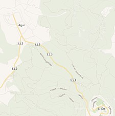
| Current Localities | Agur,[3] Tzafririm,[3] Givat Yeshayahu,[3] Li-On,[3] Tirosh[3] Britannia Park[6] |
Preview warning: Page using Template:Infobox settlement with unknown parameter "image size"
'Ajjur (Arabic: عجّور) was a Palestinian Arab village of over 3,700 inhabitants in 1945, located 24 kilometres (15 mi) northwest of Hebron. It became depopulated in 1948 after several military assaults by Israeli military forces. Agur, Tzafririm, Givat Yeshayahu, Li-On, and Tirosh were built on the village lands.
- ^ Palmer, 1881, p.265
- ^ Morris, 2004, p. xix, village #294. Also gives the cause of depopulation.
- ^ a b c d e f Cite error: The named reference
Khalidi2was invoked but never defined (see the help page). - ^ Government of Palestine, Department of Statistics, 1945, p. 23
- ^ Government of Palestine, Department of Statistics. Village Statistics, April 1945. Quoted in Hadawi, 1970, p. 50Accessed 2011-10-27. 2009-07-20.
- ^ Dear Prince William, if you have to go, make it count, Robert Cohen, March 10, 2018, Mondoweiss
© MMXXIII Rich X Search. We shall prevail. All rights reserved. Rich X Search


