Back Terratrèmol de Sumatra del 2009 Catalan Zemětřesení na Sumatře 2009 Czech Sumatra-Erdbeben vom September 2009 German Terremoto de Sumatra de 2009 Spanish 2009ko Sumatrako lurrikara Basque زمینلرزه ۲۰۰۹ سوماترا Persian Sumatran maanjäristys 2009 Finnish Séisme de 2009 à Sumatra French רעידת האדמה בסומטרה (2009) HE Gempa bumi Sumatra Barat 2009 ID
 A government building damaged by the earthquake | |
| UTC time | 2009-09-30 10:16:10 |
|---|---|
| ISC event | 13801688 |
| USGS-ANSS | ComCat |
| Local date | 30 September 2009 |
| Local time | 17:16:10 WIB |
| Magnitude | 7.6 Mw[1] |
| Depth | 90 km (56 mi)[1] |
| Epicenter | 0°43′S 99°58′E / 0.71°S 99.97°E[1] |
| Type | Reverse[2] |
| Areas affected | West Sumatra |
| Max. intensity | MMI VIII (Severe)[2] |
| Tsunami | 27 cm (11 in)[2] |
| Landslides | Yes |
| Casualties | 1,115 dead 2,180 injured[3] |
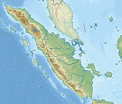
The first of the 2009 Sumatra earthquakes (Indonesian: Gempa bumi Sumatra 2009) occurred on 30 September off the coast of Sumatra, Indonesia with a moment magnitude of 7.6 at 17:16:10 local time. The epicenter was 45 kilometres (28 mi) west-northwest of Padang, West Sumatra, and 220 kilometres (140 mi) southwest of Pekanbaru, Riau. Government and authorities confirmed 1,115 dead, 1,214 severely injured and 1,688 slightly injured.[3] The most deaths occurred in the areas of Padang Pariaman (675), Padang (313), Agam (80) and Pariaman (37).[3] In addition, around 135,000 houses were severely damaged, 65,000 houses were moderately damaged and 79,000 houses were slightly damaged.[3] An estimated 250,000 families (1,250,000 people) have been affected by the earthquake through the total or partial loss of their homes and livelihoods.[4]
- ^ a b c Cite error: The named reference
ISC-GEMwas invoked but never defined (see the help page). - ^ a b c Cite error: The named reference
usgswas invoked but never defined (see the help page). - ^ a b c d "ANTARA News: Number of fatalities in W Sumatra quake now 1,115". Archived from the original on 15 October 2009. Retrieved 14 October 2009.
- ^ http://www.reliefweb.int/rw/rwb.nsf/db900SID/EDIS-7WSKEP[permanent dead link]
© MMXXIII Rich X Search. We shall prevail. All rights reserved. Rich X Search

