Back أبو كشك Arabic ابو كشك ARZ Abu Kishk French אבו כישכ HE Abu Kishk ID Abu Kiszk Polish ابو کشک Urdu
Abu Kishk
ابو كشْك | |
|---|---|
Village | |
 Old school of Abu Kishk | |
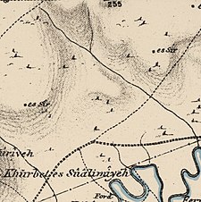
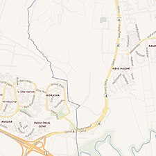
A series of historical maps of the area around Abu Kishk (click the buttons) | |
Location within Mandatory Palestine | |
| Coordinates: 32°8′11″N 34°51′55″E / 32.13639°N 34.86528°E | |
| Palestine grid | 136/170 |
| Geopolitical entity | Mandatory Palestine |
| Subdistrict | Jaffa |
| Date of depopulation | 30 March 1948[4] |
| Area | |
| • Total | 17,121 dunams (17.121 km2 or 6.610 sq mi) |
| Population (1945) | |
| • Total | 1,900[1][2][3] |
| Cause(s) of depopulation | Fear of being caught up in the fighting |
| Secondary cause | Influence of nearby town's fall |
| Current Localities | Herzliya[5] |
Abu Kishk (Arabic: أبو كشك) was a Palestinian village in the Jaffa Subdistrict located 12 km northeast of Jaffa, situated 2 km northwest of the Yarkon River. The village was depopulated during the 1947–1948 Civil War in Mandatory Palestine on 30 March 1948 by the Irgun.
In 1945 the population of the village was about 1,900; about 300 of them lived in the area that later became Herzliya after the establishment of the state of Israel.[6]
- ^ Government of Palestine, Department of Statistics, 1945, p. 27
- ^ a b Government of Palestine, Department of Statistics. Village Statistics, April, 1945. Quoted in Hadawi, 1970, p. 52
- ^ Cite error: The named reference
Khalidi235was invoked but never defined (see the help page). - ^ Morris, 2004, p. xviii, village #197. Also gives causes of depopulation
- ^ Khalidi, 1992, p. 236
- ^ Herzliya, "Mother of the Kibbutzim and the Communal Groups", by Dan Yahav. Yaron Golan Publishers.
© MMXXIII Rich X Search. We shall prevail. All rights reserved. Rich X Search


