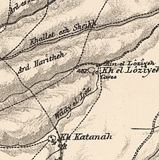
Al-Wayziyya
الويزية Weiziya[1] | |
|---|---|
Village | |
A series of historical maps of the area around Al-Wayziyya (click the buttons) | |
Location within Mandatory Palestine | |
| Coordinates: 33°0′4″N 35°34′37″E / 33.00111°N 35.57694°E | |
| Palestine grid | 204/267 |
| Geopolitical entity | Mandatory Palestine |
| Subdistrict | Safad |
| Date of depopulation | May 1948[1] |
| Population (1945) | |
| • Total | 100[2][3] |
Al-Wayziyya (Arabic: الويزية) was a Palestinian village in the Safad Subdistrict, located south east of Yarda. It was depopulated during the 1947–48 Civil War in Mandatory Palestine on May 1, 1948, by the Palmach's First Battalion of Operation Yiftach. It was located 8.5 km northeast of Safad.
In 1945, the village had a population of 100. A shrine for a local sage known as al-Shaykh al-Wayzi was located in the village.
© MMXXIII Rich X Search. We shall prevail. All rights reserved. Rich X Search


