Back Alakit (kuksa) AVK Alakit (suba sa Rusya, Respublika Sakha) CEB Alakit Italian Алакит Russian 阿拉基特河 Chinese
| Alakit Алакит | |
|---|---|
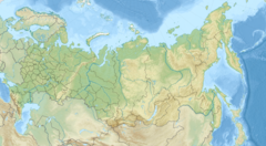
 Course of the Alakit ONC map section | |
Mouth location in Yakutia, Russia | |
| Location | |
| Country | Russia |
| Physical characteristics | |
| Source | |
| • location | Alakit-Kyuel |
| • coordinates | 65°53′21″N 110°53′51″E / 65.88917°N 110.89750°E |
| • elevation | 628 m (2,060 ft) |
| Mouth | Olenyok |
• coordinates | 67°07′41″N 109°54′16″E / 67.12806°N 109.90444°E 67°07′41″N 109°54′16″E |
• elevation | 197 m (646 ft) |
| Length | 232 km (144 mi) (344 km (214 mi)) |
| Basin size | 11,800 km2 (4,600 sq mi) |
| Basin features | |
| Progression | Olenyok→Laptev Sea |
The Alakit (Russian: Алакит) is a river in Yakutia (Sakha Republic), Russia. It is a tributary of the Olenyok with a length of 232 kilometres (144 mi) and a drainage basin area of 11,800 square kilometres (4,600 sq mi).[1]
The river flows across a lonely, desolate area of Mirninsky and Olenyoksky districts. Currently there are no settlements, but a small village named Alakit was located by the river in its upper course, a little upstream of the mouth of the Yuyose-Delingde, a left tributary.[2][3]
The Daldyn-Alakit kimberlite field is located between the upper Alakit in the west and the Daldyn River by Udachnaya in the east.[4][5]
- ^ "Река Алакит in the State Water Register of Russia". textual.ru (in Russian).
- ^ Google Earth
- ^ Cite error: The named reference
STMwas invoked but never defined (see the help page). - ^ Alakit and Daldyn kimberlite fields, Siberia, Russia: Two types of mantle sub-terranes beneath central Yakutia?
- ^ Kargin, A. V.; Golubeva, Yu. Yu.; Kononova, V. A. (2011). "Kimberlites of the Daldyn-Alakit region (Yakutia): Spatial distribution of the rocks with different chemical characteristics". Petrology. 19 (5): 496–520. Bibcode:2011Petro..19..496K. doi:10.1134/S086959111105002X.
© MMXXIII Rich X Search. We shall prevail. All rights reserved. Rich X Search

