Back Alb (Hochrhein) ALS الب (نهر فى بادن-فورتمبيرج) ARZ Alb (suba sa Alemanya, lat 47,58, long 8,13) CEB Альб (анатри Рейн юппи) CV Alb (Hochrhein) German Alb (Sur) Spanish آلب (راین هایرن) Persian Alb (dopływ Renu koło Albbruck) Polish Alb, Rin Romanian Альб (нижний приток Рейна) Russian
| Alb | |
|---|---|
 View from Spießhorn eastward into Menzenschwander Alb valley | |
| Location | |
| Country | Germany |
| Location | Black Forest |
| Physical characteristics | |
| Source | |
| • location | Menzenschwander Alb |
| • coordinates | 47°51′42″N 8°1′37″E / 47.86167°N 8.02694°E |
| • elevation | 1,347 m (4,419 ft) |
| Mouth | |
• location | Confluence with High Rhine at Albbruck |
• coordinates | 47°35′3″N 8°7′43″E / 47.58417°N 8.12861°E |
• elevation | 308 m (1,010 ft) |
| Length | 43.6 km (27.1 mi) [1] |
| Basin size | 243 km2 (94 sq mi) [1] |
| Basin features | |
| Progression | Rhine→ North Sea |
| Tributaries | |
| • right | Ibach, Höllbach |
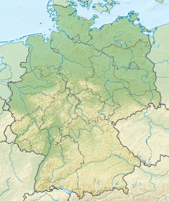
The Alb (also: Hauensteiner Alb) is a river in the southern Black Forest. It arises from two headwaters, the Menzenschwander Alb and Bernauer Alb, and flows in a southerly direction. It ends after 43.6 kilometres (27.1 mi) (including Menzenschwander Alb) at a confluence with the High Rhine at Albbruck.
© MMXXIII Rich X Search. We shall prevail. All rights reserved. Rich X Search
