Back أميليا (أومبريا) Arabic اميليا (بلده فى مقاطعه تيرنى) ARZ امیلیا، امبریا AZB Амелия Bulgarian Amelia (Italia) Breton Амелиа CE Amelia (munisipyo) CEB Amelia (Umbrien) German Αμέλια (Ούμπρια) Greek Amelia Esperanto
Amelia | |
|---|---|
| Città di Amelia | |
 | |
| Coordinates: 42°33′N 12°25′E / 42.550°N 12.417°E | |
| Country | Italy |
| Region | Umbria |
| Province | Terni (TR) |
| Frazioni | Collicello, Foce, Fornole, Macchie, Montecampano, Sambucetole, Porchiano del Monte |
| Government | |
| • Mayor | Laura Pernazza |
| Area | |
| • Total | 132 km2 (51 sq mi) |
| Elevation | 406 m (1,332 ft) |
| Population (1 January 2016)[2] | |
| • Total | 11,897 |
| • Density | 90/km2 (230/sq mi) |
| Demonym | Amerini |
| Time zone | UTC+1 (CET) |
| • Summer (DST) | UTC+2 (CEST) |
| Postal code | 05022 |
| Dialing code | 0744 |
| Patron saint | Saint Fermina |
| Saint day | November 24 |
| Website | Official website |
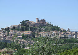
Amelia is a town and comune located in central Italy which is part of the province of Terni. The city is located in Umbria not far from the border with Lazio.
- ^ "Superficie di Comuni Province e Regioni italiane al 9 ottobre 2011". Italian National Institute of Statistics. Retrieved 16 March 2019.
- ^ "Popolazione Residente al 1° Gennaio 2018". Italian National Institute of Statistics. Retrieved 16 March 2019.
© MMXXIII Rich X Search. We shall prevail. All rights reserved. Rich X Search


