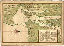

Andries Hudde (1608–1663) was a landowner and colonial official of New Netherland.
- ^ Burrows, Edwin G.; Wallace, Mike (1998-11-19). Gotham: A History of New York City to 1898. Oxford University Press. p. 36. ISBN 9780199729104.
© MMXXIII Rich X Search. We shall prevail. All rights reserved. Rich X Search
