Back Ashmore- en Cartiereilande Afrikaans Islas Ashmore y Cartier AN جزر أشمور وكارتيير Arabic Islles Ashmore y Cartier AST Aşmor və Kartye adaları Azerbaijani Астравы Ашмор і Карцье Byelorussian Астравы Ашмор і Карт’е BE-X-OLD Ашмор и Картие Bulgarian Ostrva Ashmore i Cartier BS Illes Ashmore i Cartier Catalan
 Location of the Ashmore and Cartier Islands | |
| Geography | |
|---|---|
| Location | Indian Ocean |
| Coordinates | 12°15′30″S 123°02′30″E / 12.25833°S 123.04167°E |
| Major islands | 4 |
| Administration | |
| Demographics | |
| Population | 0 (July 2021) |

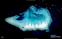
The Territory of Ashmore and Cartier Islands[1] is an uninhabited Australian external territory[2] consisting of four low-lying tropical islands in two separate reefs (Ashmore and Cartier), as well as the 12-nautical-mile (22 km; 14 mi) territorial sea generated by the islands.[3] The territory is located in the Indian Ocean situated on the edge of the continental shelf, about 320 km (199 mi) off the northwest coast of Australia and 144 km (89 mi) south of the Indonesian island of Rote.[3]
Ashmore Reef is called Pulau Pasir by Indonesians and Nusa Solokaek in the Rotenese language. Both names have the meaning "sand island".[4]
- ^ "Ashmore and Cartier Islands". The World Factbook (2024 ed.). Central Intelligence Agency.
- ^ "10: External territories". Legal Risk in International Transactions (ALRC Report 80). Australian Law Reform Commission (ALRC), Australian Government. 2006. ISBN 0642254877. Archived from the original on 16 April 2014. Retrieved 14 April 2014.
- ^ a b "Ashmore and Cartier Islands". Territories of Australia. Department of the Infrastructure and Regional Development, Australian Government. 29 January 2014. Retrieved 14 April 2014.
- ^ "A STUDY OF SOCIO-ECONOMIC ISSUES FACING TRADITIONAL INDONESIAN FISHERS WHO ACCESS THE MOU BOX" (PDF). Archived from the original (PDF) on 27 August 2006.
© MMXXIII Rich X Search. We shall prevail. All rights reserved. Rich X Search