Back مقاطعة باراجا (ميشيغان) Arabic Baraga County, Michigan BAR Барага (окръг, Мичиган) Bulgarian বারাগা কাউন্টি, মিশিগান BPY Baraga Gông (Michigan) CDO Baraga County CEB Baraga County Czech Baraga County, Michigan Welsh Baraga County German Kantono Baraga Esperanto
Baraga County | |
|---|---|
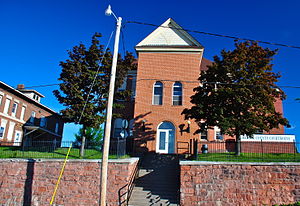
 Baraga County Courthouse and Annex (July 2014) | |
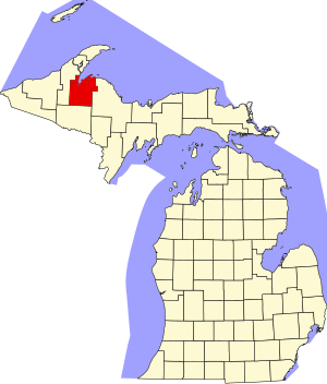
 Location within the U.S. state of Michigan | |
 Michigan's location within the U.S. | |
| Coordinates: 46°43′N 88°20′W / 46.72°N 88.34°W | |
| Country | |
| State | |
| Founded | February 19, 1875[1][2] |
| Named for | Frederic Baraga |
| Seat | L'Anse |
| Largest village | Baraga |
| Area | |
| • Total | 1,069 sq mi (2,770 km2) |
| • Land | 898 sq mi (2,330 km2) |
| • Water | 171 sq mi (440 km2) 16% |
| Population (2020) | |
| • Total | 8,158 |
| • Density | 9.9/sq mi (3.8/km2) |
| Time zone | UTC−5 (Eastern) |
| • Summer (DST) | UTC−4 (EDT) |
| Congressional district | 1st |
| Website | keweenawbay |
Baraga County (/ˈbɛərəɡə/ BAIR-ə-gə) is a county in the Upper Peninsula in the U.S. state of Michigan. As of the 2020 census, the population was 8,158, making it Michigan's fifth-least populous county.[3] The county seat is L'Anse.[4] The county is named after Bishop Frederic Baraga, a Catholic missionary who ministered to the Ojibwa Indians in the Michigan Territory.[1]
The L'Anse Indian Reservation of the Ojibwa is within Baraga County.
- ^ a b "Bibliography on Baraga County". Clarke Historical Library, Central Michigan University. Retrieved January 19, 2013.
- ^ "jengod.com".
- ^ "State & County QuickFacts". US Census Bureau. Retrieved September 15, 2021.
- ^ "Find a County". National Association of Counties. Retrieved June 7, 2011.
© MMXXIII Rich X Search. We shall prevail. All rights reserved. Rich X Search

