Bathurst Street | |
|---|---|
 | |
| Bathurst Street | |
 | |
| Coordinates | |
| General information | |
| Type | Street |
| Length | 650 m (0.4 mi)[1] |
| Major junctions | |
| West end | Harbour Street Sydney CBD |
| East end | Elizabeth Street Sydney CBD |
| ---- | |
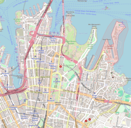
Bathurst Street is a street in the Sydney central business district in New South Wales, Australia. Bathurst Street runs for 650 metres (2,130 ft) in a west–east direction with traffic flowing in this direction only.[1][2] It is situated in the southern portion of the central business district. The western terminus of Bathurst Street is at Harbour Street, Darling Harbour, with the eastern terminus at Elizabeth Street, adjacent to Hyde Park.
From west to east, Bathurst Street crosses Sussex, George, Pitt, and Castlereagh streets.
Bathurst Street was named by Governor Macquarie in honour of Henry Bathurst, 3rd Earl Bathurst, the UK Secretary of State for War and the Colonies between 1812 and 1827.[3][4] In conjunction with the opening of the Glebe Island Bridge, in December 1995 a bus lane was opened from Harbour to George Streets.[5]
- ^ a b Bathurst St, Sydney NSW 2000 to 120 Elizabeth St, Sydney NSW 2000 (Map). Google Maps. 2016. Retrieved 27 December 2016.
- ^ Maps C, D (Map). Gregory's Sydney Street Directory. 2002.
- ^ "What's in a name?". Sydney Streets. City of Sydney. 2003. Archived from the original on 30 December 2016. Retrieved 29 December 2016.
- ^ "History of Sydney Streets" (MS Excel (for download)). Sydney Streets. City of Sydney. 4 December 2012. Retrieved 29 December 2016.
- ^ Central City Bus Priority Scheme Australian Bus Panorama issue 13/1 August 1997 page 33
© MMXXIII Rich X Search. We shall prevail. All rights reserved. Rich X Search

