Back باجة (البرتغال) Arabic باجه ARZ Beja Azerbaijani Бежа Byelorussian Бежа Bulgarian Beja (Portugal) Breton Beja (municipi de Portugal) Catalan Бежа CE Beja (munisipyo) CEB Beja Czech
Beja | |
|---|---|
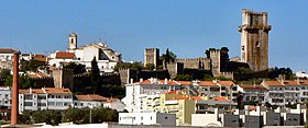
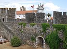
Beja Castle, Nossa Senhora da Conceição Convent, Interior of Beja Castle, the Castle Watchtower, Republic Square, Santa Maria da Feira church | |
 | |
| Coordinates: 38°02′N 7°53′W / 38.033°N 7.883°W | |
| Country | |
| Region | Alentejo |
| Intermunic. comm. | Baixo Alentejo |
| District | Beja |
| Parishes | 11 |
| Government | |
| • President | Paulo Arsénio (PS) |
| Area | |
| • Total | 1,146.44 km2 (442.64 sq mi) |
| Population (2011) | |
| • Total | 35,854 |
| • Density | 31/km2 (81/sq mi) |
| Time zone | UTC±00:00 (WET) |
| • Summer (DST) | UTC+01:00 (WEST) |
| Local holiday | Ascension Day (date varies) |
| Website | www |
Beja (Portuguese pronunciation: [ˈbɛʒɐ] ) is a city and a municipality in the Alentejo region, Portugal. The population in 2011 was 35,854,[1] in an area of 1,146.44 km2 (442.64 sq mi).[2] The city proper had a population of 21,658 in 2001.[3]
The municipality is the capital of the Beja District. The present Mayor is Paulo Arsénio, elected by the Socialist Party with an absolute majority in the 2017 Portuguese Local Elections.[4] The municipal holiday is Ascension Day. The Portuguese Air Force has an airbase in the area – the Air Base No. 11.
- ^ Instituto Nacional de Estatística. Ine.pt. Retrieved on 2015-10-27.
- ^ "Áreas das freguesias, concelhos, distritos e país". Archived from the original on 2018-11-05. Retrieved 2018-11-05.
- ^ UMA POPULAÇÃO QUE SE URBANIZA, Uma avaliação recente – Cidades, 2004 Archived October 6, 2014, at the Wayback Machine Nuno Pires Soares, Instituto Geográfico Português (Geographic Institute of Portugal)
- ^ Beja – PS conquista Câmara à CDU com maioria absoluta Archived December 13, 2013, at the Wayback Machine Diário de Notícias, October 2009. Retrieved June 2012
© MMXXIII Rich X Search. We shall prevail. All rights reserved. Rich X Search


