Back Belfast Lough CEB Belfast Lough Czech Belfast Lough Spanish Belfast aintzira Basque Belfast Lough French Loch Lao Irish Belfast Lough Italian Belfast Lough Dutch Belfast Lough NN Belfast Lough NB
| Belfast Lough Loch Lao (Irish) Bilfawst Loch (Ulster-Scots)[1] | |
|---|---|
 Satellite photo | |
| Location | Northern Ireland |
| Coordinates | 54°41′28″N 5°47′06″W / 54.691°N 5.785°W |
| Designated | 5 August 1998 |
| Reference no. | 958[2] |


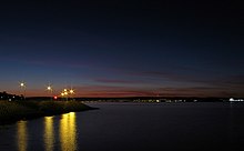
Belfast Lough (Irish: Loch Lao) is a large, intertidal sea inlet on the east coast of Northern Ireland. At its head is the city and port of Belfast, which sits at the mouth of the River Lagan. The lough opens into the North Channel and connects Belfast to the Irish Sea.
Belfast Lough is a long, wide and deep expanse of water, virtually free of strong tides. The inner part of the lough comprises a series of mudflats and lagoons. The outer lough is restricted to mainly rocky shores with some small sandy bays. The outer boundary of the lough is a line joining Orlock Point and Blackhead.
The main coastal towns are Bangor on the southern shore (County Down) and Carrickfergus on the northern shore (County Antrim). Other coastal settlements include Holywood, Helen's Bay, Greenisland and Whitehead.
- ^ "Blackbird Festival" (PDF). Forbairt Feirste. Archived from the original (PDF) on 25 April 2012. Retrieved 10 April 2017.
- ^ "Belfast Lough". Ramsar Sites Information Service. Archived from the original on 30 May 2018. Retrieved 25 April 2018.
© MMXXIII Rich X Search. We shall prevail. All rights reserved. Rich X Search
![Belfast Lough Loch Lao (Irish) Bilfawst Loch (Ulster-Scots)[1] is located in Greater Belfast](http://upload.wikimedia.org/wikipedia/commons/thumb/e/e9/GreaterBelfastTemplate.gif/256px-GreaterBelfastTemplate.gif)