Back Belize-stad Afrikaans مدينة بليز Arabic بليز ARZ Ciudá de Belize AST Беліз (горад) Byelorussian Бэліз (горад) BE-X-OLD Белиз Сити Bulgarian বেলিজ শহর Bengali/Bangla Belize City Catalan Belize City CEB
Belize City | |
|---|---|
City | |
| City of Belize | |
 From top; left to right: St. John's Cathedral, the Government House, the CARICOM Flag Monument, the Bliss Institute, Aerial of Belize City, Princess Hotel and Casino, the Central Bank of Belize, High Court Building and the Swing Bridge | |
| Etymology: From the Belize River, corruption of Balis, word that comes from the Mayan language. | |
| Nicknames: The Old Capital, The City | |
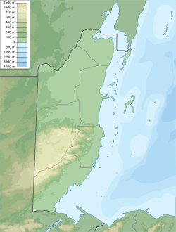
| Coordinates: 17°29′55″N 88°11′19″W / 17.49861°N 88.18861°W[1] | |
| Country | Belize |
| District | Belize |
| Settled | 1638 (as a camp)[2] 1650s (as a port) 1783 (as a town) |
| Incorporated | 1783 (as capital) 1981 (as a city) |
| Founded by | Peter Wallace |
| Named after | Peter Wallace |
| Government | |
| • Type | Mayor–council |
| • Body | City Council |
| • Mayor | Bernard Wagner (PUP) |
| • Belize Parliament | 10 constituencies |
| Area | |
• Total | 13.77 sq mi (35.7 km2) |
| Elevation | 0 ft (0 m) |
| Population (2024 estimate) | |
• Total | 65,222 |
| • Density | 4,700/sq mi (1,800/km2) |
| Demonym | Belizean |
| Time zone | UTC−6 (GMT-6) |
| Website | belizecitycouncil.org |
Belize City is the largest city in Belize. It was once the capital of the former British Honduras. According to the 2022 census, Belize City has a population of 63,999 people.[3] It is at the mouth of the Haulover Creek, which is a distributary of the Belize River. The Belize River empties into the Caribbean Sea eight kilometres (five miles) from Belize City on the Philip Goldson Highway on the coast of the Caribbean. The city is the country's principal port and its financial and industrial hub. Cruise ships drop anchor outside the port and are tendered by local citizens. The city was almost entirely destroyed in October 1961 when Hurricane Hattie swept ashore. It was the capital of British Honduras (as Belize was then named) until the government was moved to the new capital of Belmopan in 1970.[4]
- ^ "Belize City, Belize". Google Maps. Retrieved 20 August 2011.
- ^ "History". Belize City Council. Archived from the original on 23 July 2014. Retrieved 11 July 2014.
- ^ "Belize: Districts, Towns & Villages - Population Statistics, Maps, Charts, Weather and Web Information". www.citypopulation.de. Retrieved 25 October 2024.
- ^ "belmopanbelize.com". belmopanbelize.com. Archived from the original on 22 July 2010. Retrieved 29 June 2010.
© MMXXIII Rich X Search. We shall prevail. All rights reserved. Rich X Search


