Back Bethlehem (Nou Hampshire) Catalan Бетлегем (Нью-Гэмпшир) CE Bethlehem (lungsod sa Tinipong Bansa, New Hampshire) CEB Bethlehem, New Hampshire Welsh Bethlehem (New Hampshire) German Bethlehem (Nuevo Hampshire) Spanish بتلیهم، نیوهمپشایر Persian Bethlehem (New Hampshire) French Bethlehem, New Hampshire HT Bethlehem (New Hampshire, város) Hungarian
Bethlehem, New Hampshire | |
|---|---|
Town | |
 Main street of Bethlehem, spring 2009 | |
| Motto: Star of the White Mountains | |
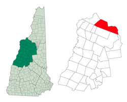
 Location in Grafton County, New Hampshire | |
| Coordinates: 44°16′49″N 71°41′17″W / 44.28028°N 71.68806°W | |
| Country | United States |
| State | New Hampshire |
| County | Grafton |
| Incorporated | 1799 |
| Villages |
|
| Government | |
| • Select Board |
|
| • Town Administrator | Mary Moritz |
| Area | |
| • Total | 91.0 sq mi (235.6 km2) |
| • Land | 90.6 sq mi (234.7 km2) |
| • Water | 0.3 sq mi (0.9 km2) 0.39% |
| Elevation | 1,426 ft (435 m) |
| Population (2020)[2] | |
| • Total | 2,484 |
| • Density | 27/sq mi (10.6/km2) |
| Time zone | UTC-5 (Eastern) |
| • Summer (DST) | UTC-4 (Eastern) |
| ZIP code | 03574 |
| Area code | 603 |
| FIPS code | 33-05460 |
| GNIS feature ID | 0873546 |
| Website | www |
Bethlehem is a hillside town in Grafton County, New Hampshire, United States. The population was 2,484 at the 2020 census.[2] It is home to Cushman and Strawberry Hill state forests. The eastern half of the town is within the White Mountain National Forest. The Appalachian Trail crosses a small portion of the town in the south.
The main village of the town, where 826 people resided at the 2020 census, is defined as the Bethlehem census-designated place (CDP), and is located at the junction of U.S. Route 302 with New Hampshire Route 142. The town also includes the villages of Maplewood and Pierce Bridge.
- ^ "2021 U.S. Gazetteer Files – New Hampshire". United States Census Bureau. Retrieved November 19, 2021.
- ^ a b "Bethlehem town, Grafton County, New Hampshire: 2020 DEC Redistricting Data (PL 94-171)". U.S. Census Bureau. Retrieved November 19, 2021.
© MMXXIII Rich X Search. We shall prevail. All rights reserved. Rich X Search