Back Propinsi Biliran ACE بيليران Arabic Biliran adası Azerbaijani بیلیران AZB Biliran BCL Biliran CBK-ZAM Biliran CEB Biliran German Bilirano Esperanto Provincia de Biliran Spanish
Biliran | |
|---|---|
| Province of Biliran | |
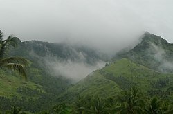
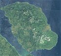
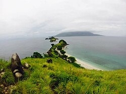
clockwise from top: mountains of Caibiran, Downtown Naval, Sambawan Island, Biliran island satellite in 2016 | |
 Location in the Philippines | |
| Coordinates: 11°35′N 124°29′E / 11.58°N 124.48°E | |
| Country | Philippines |
| Region | Eastern Visayas |
| Founded | 11 May 1992 |
| Capital and largest town | Naval |
| Government | |
| • Governor | Gerard Roger M. Espina (NP) |
| • Vice Governor | Brigido C. Caneja III (NP) |
| • Legislature | Biliran Provincial Board |
| Area | |
| • Total | 536.01 km2 (206.95 sq mi) |
| • Rank | 78th out of 81 |
| Highest elevation | 1,346 m (4,416 ft) |
| Population (2020 census)[3] | |
| • Total | 179,312 |
| • Rank | 75th out of 81 |
| • Density | 330/km2 (870/sq mi) |
| • Rank | 21st out of 81 |
| Divisions | |
| • Independent cities | 0 |
| • Component cities | 0 |
| • Municipalities | |
| • Barangays | 132 |
| • Districts | Lone district of Biliran |
| Time zone | UTC+8 (PHT) |
| IDD : area code | +63 (0)53 |
| ISO 3166 code | PH-BIL |
| Spoken languages | |
| Income classification | 4th class |
| Website | biliran |
Biliran, officially the Province of Biliran (Waray-Waray: Probinsya han Biliran; Cebuano: Lalawigan sa Biliran; Tagalog: Lalawigan ng Biliran), is an island province in the Philippines located in the Eastern Visayas region (Region VIII). Biliran is one of the country's smallest and newest provinces. Formerly a sub-province of Leyte, it became an independent province in 1992.
Biliran lies less than a kilometer north of the island of Leyte. A bridge-causeway fixed link over Poro Island in the gateway town of Biliran connects the province to Leyte.[4] Its capital is the municipality of Naval on the western coast of the island.
- ^ "List of Provinces". PSGC Interactive. Makati City, Philippines: National Statistical Coordination Board. Archived from the original on 19 April 2016. Retrieved 5 March 2020.
- ^ "Biliran". Global Volcanism Program. Smithsonian Institution. Retrieved 2013-11-14.
- ^ Census of Population (2020). "Region VIII (Eastern Visayas)". Total Population by Province, City, Municipality and Barangay. Philippine Statistics Authority. Retrieved 8 July 2021.
- ^ "Poro Island, Biliran, Eastern Visayas, Philippines". Google Maps. Retrieved on 2013-11-15.
© MMXXIII Rich X Search. We shall prevail. All rights reserved. Rich X Search


