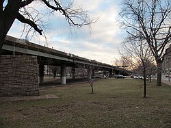
Philip G. Bowker Overpass | |
|---|---|
 Bowker Overpass at Commonwealth Avenue | |
| Coordinates | 42°20′57.36″N 71°5′32.31″W / 42.3492667°N 71.0923083°W |
| Carries | The Charlesgate |
| Crosses | Ipswich Street Framingham/Worcester Line Commonwealth Avenue Beacon Street |
| Locale | Boston, Massachusetts |
| Characteristics | |
| Material | Steel |
| Total length | 0.2 miles (0.3 km)[1] |
| History | |
| Opened | 1965 |
| Location | |
 | |
Philip G. Bowker Overpass, named for a state senator, is a steel beam bridge with a suspended deck carrying The Charlesgate over Commonwealth Avenue, Beacon Street, and Interstate 90. It connects Boylston Street to Storrow Drive. It runs parallel to the Muddy River. In 2011, there was talk about tearing down the bridge and widening local streets as some consider the bridge to be an eyesore, as well as the fact that it bisects a portion of the Emerald Necklace.[2]
- ^ Cite error: The named reference
googlemapswas invoked but never defined (see the help page). - ^ Moskovitz, Eric (March 12, 2011). "Pothole renews debate on overpass-Neighbors want Bowker torn down". The Boston Globe. Retrieved 13 March 2011.
© MMXXIII Rich X Search. We shall prevail. All rights reserved. Rich X Search
