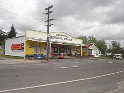
Broadwood | |
|---|---|
 Broadwood General Store | |
 | |
| Coordinates: 35°15′38″S 173°23′36″E / 35.26056°S 173.39333°E | |
| Country | New Zealand |
| Region | Northland Region |
| District | Far North District |
| Ward | Kaikohe/Hokianga |
| Electorates | |
| Government | |
| • Territorial Authority | Far North District Council |
| • Regional council | Northland Regional Council |
| Population | |
| • Total | 135 |
Broadwood is a town about 25 km to the north of the north side of the Hokianga harbour, in Northland, New Zealand. Herekino is 21 km to the west, and Mangamuka Bridge is the same distance to the east.[1][2]
The Broadwood area was first settled by Pākehā in the 1880s, and an access road was constructed through the area from Takahue to Motukaraka on the Hokianga harbour. An unmetalled road through the Te Karae Valley to Kohukohu was constructed in 1908.[3]
- ^ Peter Dowling, ed. (2004). Reed New Zealand Atlas. Reed Books. pp. map 3. ISBN 0-7900-0952-8.
- ^ Roger Smith, GeographX (2005). The Geographic Atlas of New Zealand. Robbie Burton. pp. map 18. ISBN 1-877333-20-4.
- ^ Olive Harris and Chris Lancaster, ed. (2006). "Nearby Broadwood and Runaruna". Remember the Hokianga. p. 89. ISBN 978-0-473-11859-4.
© MMXXIII Rich X Search. We shall prevail. All rights reserved. Rich X Search
