Back مقاطعة براون (تكساس) Arabic Brown County, Texas BAR Браўн (акруга, Тэхас) Byelorussian Браун (окръг, Тексас) Bulgarian ব্রাউন কাউন্টি, টেক্সাস BPY Brown Gông (Texas) CDO Brown County (kondado sa Tinipong Bansa, Texas) CEB Brown County (Texas) Czech Brown County, Texas Welsh Brown County (Texas) German
Brown County | |
|---|---|
 The Brown County Courthouse in Brownwood | |
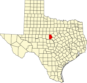
 Location within the U.S. state of Texas | |
 Texas's location within the U.S. | |
| Coordinates: 31°46′N 99°00′W / 31.77°N 99°W | |
| Country | |
| State | |
| Founded | 1858 |
| Named for | Henry Stevenson Brown |
| Seat | Brownwood |
| Largest city | Brownwood |
| Area | |
| • Total | 957 sq mi (2,480 km2) |
| • Land | 944 sq mi (2,440 km2) |
| • Water | 13 sq mi (30 km2) 1.3% |
| Population (2020) | |
| • Total | 38,095 |
| • Density | 40/sq mi (15/km2) |
| Time zone | UTC−6 (Central) |
| • Summer (DST) | UTC−5 (CDT) |
| Congressional district | 11th |
| Website | www |
Brown County is a county in west-central Texas. As of the 2020 census, the population was 38,095.[1][2] Its county seat is Brownwood.[3] The county was founded in 1856 and organized in 1858.[4] It is named for Henry Stevenson Brown, a commander at the Battle of Velasco, an early conflict between Texians and Mexicans.
The Brownwood, TX Micropolitan Statistical Area includes all of Brown County.
- ^ "U.S. Census Bureau QuickFacts: Brown County, Texas". United States Census Bureau. Retrieved January 31, 2022.
- ^ "Brown County, Texas". United States Census Bureau. Retrieved February 23, 2021.
- ^ "Find a County". National Association of Counties. Archived from the original on May 31, 2011. Retrieved June 7, 2011.
- ^ "Texas: Individual County Chronologies". Texas Atlas of Historical County Boundaries. The Newberry Library. 2008. Archived from the original on May 13, 2015. Retrieved May 20, 2015.
© MMXXIII Rich X Search. We shall prevail. All rights reserved. Rich X Search