Back Camærilgo ANG كاماريلو (كاليفورنيا) Arabic كاماريلو (كاليفورنيا) ARZ Camarillo (California) AST کاماریلو، کالیفورنیا AZB Камарылья (Каліфорнія) Byelorussian Камарильо (Калифорния) Bulgarian Camarillo Catalan Камарильйо CE Camarillo CEB
Camarillo, California | |
|---|---|
| City of Camarillo | |
|
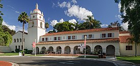
Clockwise: California State University Channel Islands; view of Camarillo; Mary Magdalene Chapel | |
|
| |
| Motto(s): "Las Personas Son la Ciudad" ("The People Are the City") | |
 Location of Camarillo in Ventura County, California | |
| Coordinates: 34°14′N 119°2′W / 34.233°N 119.033°W | |
| Country | United States |
| State | California |
| County | Ventura |
| Rail station | 1898 |
| Incorporated | October 22, 1964[1] |
| Named for | Adolfo and Juan Camarillo |
| Government | |
| • Mayor | Shawn Mulchay[2] |
| • State Senator | Monique Limón (D)[3] |
| • CA Assembly | Laura Friedman (D)[3] |
| • U. S. Rep. | Julia Brownley (D)[4] |
| • County supervisor | Kelly Long[5] |
| Area | |
| • Total | 19.70 sq mi (51.03 km2) |
| • Land | 19.69 sq mi (50.99 km2) |
| • Water | 0.02 sq mi (0.04 km2) 0.08% |
| Elevation | 177 ft (54 m) |
| Population (2020) | |
| • Total | 70,741 |
| • Density | 3,593.47/sq mi (1,387.45/km2) |
| Time zone | UTC−8 (PST) |
| • Summer (DST) | UTC−7 (PDT) |
| ZIP Codes | 93010–93012[8] |
| Area code | 805 |
| FIPS code | 06-10046 |
| GNIS feature IDs | 1652682, 2409966 |
| Website | www |
Camarillo (/ˌkæməˈriːoʊ/ KAM-ə-REE-oh) is a city in Ventura County in the U.S. state of California. As of the 2020 United States Census, the population was 70,741, an increase of 5,540 from the 65,201 counted in the 2010 Census. Camarillo is named for brothers Juan and Adolfo Camarillo, prominent Californios who owned Rancho Calleguas and founded the city. California State University, Channel Islands is housed on the former grounds of the Camarillo State Hospital.
- ^ "California Cities by Incorporation Date". California Association of Local Agency Formation Commissions. Archived from the original (Word) on November 3, 2014. Retrieved August 25, 2014.
- ^ "Meet your city council". City of Camarillo, CA.
- ^ a b "Statewide Database". UC Regents. Archived from the original on February 1, 2015. Retrieved October 20, 2014.
- ^ "California's 26th Congressional District - Representatives & District Map". Civic Impulse, LLC. Retrieved October 5, 2014.
- ^ "Board of Supervisors". County of Venura. Retrieved February 1, 2015.
- ^ "2020 U.S. Gazetteer Files". United States Census Bureau. Retrieved October 30, 2021.
- ^ "Camarillo". Geographic Names Information System. United States Geological Survey, United States Department of the Interior. Retrieved October 20, 2014.
- ^ "ZIP Code(tm) Lookup". United States Postal Service. Retrieved November 7, 2014.
© MMXXIII Rich X Search. We shall prevail. All rights reserved. Rich X Search


