Back مقاطعة كنيديان (أوكلاهوما) Arabic Canadian County, Oklahoma BAR Кънейдиън (окръг, Оклахома) Bulgarian কানাডিয়ান কাউন্টি, ওকলাহোমা BPY Comtat de Canadian Catalan Canadian Gông (Oklahoma) CDO Canadian County CEB Canadian County, Oklahoma Welsh Canadian County German Condado de Canadian Spanish
Canadian County | |
|---|---|
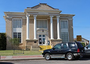
 El Reno Carnegie Library | |
 Location within the U.S. state of Oklahoma | |
 Oklahoma's location within the U.S. | |
| Coordinates: 35°32′N 97°59′W / 35.54°N 97.98°W | |
| Country | |
| State | |
| Founded | March, 1890 |
| Named for | Canadian River |
| Seat | El Reno |
| Largest city | Yukon[a] |
| Area | |
| • Total | 906 sq mi (2,350 km2) |
| • Land | 897 sq mi (2,320 km2) |
| • Water | 9.0 sq mi (23 km2) 1.0% |
| Population (2020) | |
| • Total | 154,405 |
| • Density | 170/sq mi (66/km2) |
| Time zone | UTC−6 (Central) |
| • Summer (DST) | UTC−5 (CDT) |
| Congressional districts | 3rd, 4th |
| Website | www |
Canadian County is a county located in the U.S. state of Oklahoma. As of the 2020 census, the population was 154,405,[1] making it the fourth most populous county in Oklahoma. Its county seat is El Reno.[2]
The county is named for the Canadian River, which forms part of its southern border. The river may have been named for early European explorers who were fur traders and trappers from New France, or pre-1763 colonial Canada.[3]
Canadian County is part of the Oklahoma City metropolitan statistical area.
Cite error: There are <ref group=lower-alpha> tags or {{efn}} templates on this page, but the references will not show without a {{reflist|group=lower-alpha}} template or {{notelist}} template (see the help page).
- ^ "U.S. Census Bureau QuickFacts: Canadian County, Oklahoma; United States". www.census.gov. Retrieved August 6, 2022.
- ^ "Find a County". National Association of Counties. Archived from the original on May 31, 2011. Retrieved June 7, 2011.
- ^ Oklahoma Historical Society. "Origin of County Names in Oklahoma" Archived August 14, 2017, at the Wayback Machine, Chronicles of Oklahoma 2:1 (March 1924) 75-82 (retrieved August 18, 2006).
© MMXXIII Rich X Search. We shall prevail. All rights reserved. Rich X Search