Back Kaap Agulhas Plaaslike Munisipaliteit Afrikaans Кейп Агьолас Bulgarian Cape Agulhas (munisipyo) CEB Cape Agulhas Local Municipality German Cape Agulhas (municipalité) French Municipalità locale di Cape Agulhas Italian Kaap Agulhas (gemeente) Dutch Kabe Agulhas Komunie, Sud Afrika NOV Cape Agulhas Mmusogae NSO Cape Agulhas Polish
Cape Agulhas
Kaap Agulhas | |
|---|---|
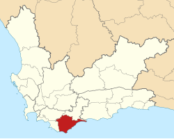
 Location in the Western Cape | |
| Coordinates: 34°30′S 20°00′E / 34.500°S 20.000°E | |
| Country | South Africa |
| Province | Western Cape |
| District | Overberg |
| Seat | Bredasdorp |
| Wards | 6 |
| Government | |
| • Type | Municipal council |
| • Mayor | Raymond Ross (DA) |
| • Deputy Mayor | Karin Donald (DA) |
| Area | |
| • Total | 3,467 km2 (1,339 sq mi) |
| Population (2022)[1] | |
| • Total | 40,274 |
| • Density | 12/km2 (30/sq mi) |
| Racial makeup (2022) | |
| • Black African | 12.6% |
| • Coloured | 60.9% |
| • Indian/Asian | 0.4% |
| • White | 23.4% |
| First languages (2011) | |
| • Afrikaans | 84.4% |
| • Xhosa | 6.0% |
| • English | 5.6% |
| • Other | 4% |
| Time zone | UTC+2 (SAST) |
| Municipal code | WC033 |
| HDI (2021) | 0.773[3] high |
Cape Agulhas Municipality (Afrikaans: Kaap Agulhas Munisipaliteit) is a municipality located in the Western Cape province of South Africa. As of 2011[update], it had a population of 33,038.[2] Its municipality code is WC033. It is named after Cape Agulhas, the southernmost point of Africa. The largest town is Bredasdorp, which is the seat of the municipal headquarters. It also includes the villages of Napier, Struisbaai, Elim, Arniston and L'Agulhas, and the De Hoop Nature Reserve.
- ^ a b "Cape Agulhas (Local Municipality, South Africa)". Population Statistics, Charts, Map and Location. 2022-02-02. Retrieved 2024-08-09.
- ^ a b "Statistics by place". Statistics South Africa. Retrieved 27 September 2015.
- ^ "Swellendam Municipality 2021" (PDF). Retrieved 13 July 2024.
© MMXXIII Rich X Search. We shall prevail. All rights reserved. Rich X Search
