Back كيب بايرون Arabic Bayron burnu Azerbaijani Байран (мыс) Byelorussian Байран (мыс) BE-X-OLD Cape Byron (punta sa Ostralya) CEB Cape Byron German Cabo Byron Spanish Byron lurmuturra Basque Cap Byron French Բայրոն (հրվանդան) Armenian
Cape Byron | |
|---|---|
 | |
| Coordinates: 28°37′58″S 153°38′20″E / 28.632778°S 153.638889°E | |
| Location | Byron Bay, NSW |
| Offshore water bodies | Tasman Sea |
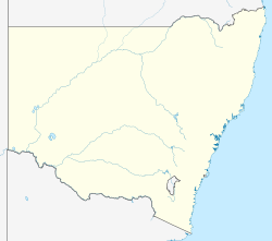
Cape Byron is the easternmost point of the mainland of Australia, located in New South Wales.[1] It is about 3 km (1.9 mi) east of the town of Byron Bay, New South Wales and projects into the Pacific Ocean at 28.6335° S, 153.6383° E. A lighthouse is situated there. It is a popular area for hiking and for whale watching. Two national parks, one a conservation area and a marine park, are on the bay.
Cape Byron has a significant influences on the open beaches to its north.[2] Longshore drift transports sand northwards. Sand blocked by the cape drops off the continental shelf, which is very narrow here, at a rate of around 50,000 cubic metres of sand per year.[2]
- ^ "Cape Byron Headland Reserve". Byron Bay. Retrieved 10 December 2019.
- ^ a b Graham, Bruce (2004). The Green Coast: The Natural Environment of the Tweed-Moreton Bioregion. Tweed Heads, New South Wales. p. 104. ISBN 0-9751817-0-X.
{{cite book}}: CS1 maint: location missing publisher (link)
© MMXXIII Rich X Search. We shall prevail. All rights reserved. Rich X Search
