Back Cape Lookout National Seashore CEB Cape Lookout National Seashore German Cape Lookout National Seashore French National Seashore di capo Lookout Italian
| Cape Lookout National Seashore | |
|---|---|
IUCN category V (protected landscape/seascape) | |
 Cape Lookout Lighthouse | |
| Location | Outer Banks, Carteret County, North Carolina, United States |
| Nearest city | Harkers Island, North Carolina |
| Coordinates | 34°36′19″N 76°32′11″W / 34.60528°N 76.53639°W |
| Area | 28,243 acres (114.30 km2)[1] |
| Established | March 10, 1966 |
| Visitors | 541,533 (in 2022)[2] |
| Governing body | National Park Service |
| Website | Cape Lookout National Seashore |
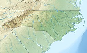
Cape Lookout National Seashore preserves a 56-mile (90-km) long section of the Southern Outer Banks, or Crystal Coast, of North Carolina, United States, running from Ocracoke Inlet on the northeast to Beaufort Inlet on the southwest. Three undeveloped barrier islands make up the seashore - North and South Core Banks and Shackleford Banks. The seashore includes two historic villages on Core Banks, Shackleford's wild horses, and the Cape Lookout Lighthouse, which has a black-and-white diamond pattern. A visitor center for the seashore is located on Harkers Island.
The National Park Service, as part of their Centennial Initiative celebrating its 100th anniversary in 2016, is planning to rehabilitate the Lighthouse and restore the Cape Lookout and Portsmouth Village Historic Districts.[3]
- ^ "Listing of acreage – December 31, 2011" (XLSX). Land Resource Division, National Park Service. Retrieved 2012-12-26. (National Park Service Acreage Reports)
- ^ "NPS Annual Recreation Visits Report". National Park Service. Retrieved October 16, 2023.
- ^ Bomar, Mary A. (August 2007). "Summary of Park Centennial Strategies" (PDF). National Park Service. Retrieved 2008-02-15.
© MMXXIII Rich X Search. We shall prevail. All rights reserved. Rich X Search

