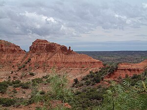
| Caprock Canyons State Park | |
|---|---|
 View from Haynes Ridge | |
 | |
| Location | Briscoe County, Texas |
| Nearest city | Quitaque |
| Coordinates | 34°26′37″N 101°03′08″W / 34.44361°N 101.05222°W |
| Area | 15,314 acres (6,197 ha) |
| Established | 1982 |
| Visitors | 78,978 (in 2022)[1] |
| Governing body | Texas Parks and Wildlife Department |
| www | |
| Caprock Canyons Trailway | |
| Length | 64 miles (103 kilometres) |
| Location | Texas |
| Use | Hiking |
| Elevation gain/loss | 2,776 ft (846 m) |
| Difficulty | Medium |
Caprock Canyons State Park and Trailway is a Texas state park located along the eastern edge of the Llano Estacado in Briscoe County, Texas, United States, approximately 100 miles (160 km) southeast of Amarillo. The state park opened in 1982 and is 15,314 acres (6,197 ha) in size, making it the third-largest state park in Texas.[2][3]
- ^ Christopher Adams. "What is the most visited state park in Texas? Here's the top 10 countdown". KXAN.com. Retrieved November 21, 2023.
- ^ Caprock Canyons State Park from the Handbook of Texas Online
- ^ Cite error: The named reference
tpwdwas invoked but never defined (see the help page).
© MMXXIII Rich X Search. We shall prevail. All rights reserved. Rich X Search
