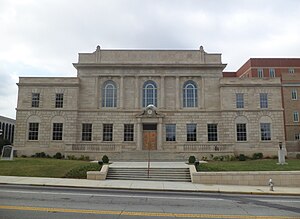
Back مقاطعة كارول (جورجيا) Arabic کارول بؤلگهسی، جورجیا AZB Carroll County, Georgia BAR Керъл (окръг, Джорджия) Bulgarian কেরোল কাউন্টি, জর্জিয়া BPY Carroll Gông (Georgia) CDO Кэррол (гуо, Джорджи) CE Carroll County (kondado sa Tinipong Bansa, Georgia) CEB Carroll County (Georgie) Czech Carroll County, Georgia Welsh
Carroll County | |
|---|---|
 | |
 Location within the U.S. state of Georgia | |
 Georgia's location within the U.S. | |
| Coordinates: 33°35′N 85°05′W / 33.58°N 85.08°W | |
| Country | |
| State | |
| Founded | June 9, 1826 |
| Named for | Charles Carroll of Carrollton |
| Seat | Carrollton |
| Largest city | Carrollton |
| Area | |
| • Total | 504 sq mi (1,310 km2) |
| • Land | 499 sq mi (1,290 km2) |
| • Water | 4.8 sq mi (12 km2) 0.9% |
| Population (2020) | |
| • Total | 119,148[1] |
| Time zone | UTC−5 (Eastern) |
| • Summer (DST) | UTC−4 (EDT) |
| Congressional district | 3rd |
| Website | www |
Carroll County is a county located in the northwestern part of the State of Georgia. As of the 2020 census, its population was 119,148.[2][1] Its county seat is the city of Carrollton.[3] Carroll County is included in the Atlanta-Sandy Springs-Roswell metropolitan statistical area and is also adjacent to Alabama on its western border.
- ^ a b US 2020 Census Bureau report, Carroll County, Georgia
- ^ "State & County QuickFacts". United States Census Bureau. Archived from the original on July 3, 2011. Retrieved June 19, 2014.
- ^ "Find a County". National Association of Counties. Archived from the original on May 31, 2011. Retrieved June 7, 2011.
© MMXXIII Rich X Search. We shall prevail. All rights reserved. Rich X Search
