Back نهر كاتاويسا كريك ARZ Catawissa Creek CEB کاتاویسا کریک Persian Catawissa Creek French Catawissa (rivus) Latin Катависа Крик (дарё) Tajik
| Catawissa Creek | |
|---|---|
 The creek near Brandonville, Pennsylvania | |
| Etymology | Corruption of the Algonquin word Gattawisi, meaning "Growing fat"[1] |
| Physical characteristics | |
| Source | |
| • location | Southwestern Luzerne County, Pennsylvania |
| Mouth | |
• location | Susquehanna River |
| Length | 41.8 mi (67.3 km) |
| Basin size | 153 sq mi (400 km2) |
| Basin features | |
| Tributaries | |
| • left | Hunkydory Creek, Spies Run, Messers Run, Davis Run, Rattling Run, Dark Run, Little Catawissa Creek, Crooked Run, Cranberry Run, Klingermans Run, Stranger Hollow, Long Hollow, Mine Gap Run, Fisher Run, Furnace Run |
| • right | Cross Run, Tomhicken Creek, Beaver Run, Scotch Run |
Catawissa Creek (colloquially known as The Cat[2]) is a 41.8-mile-long (67.3 km)[3] tributary of the Susquehanna River in east-central Pennsylvania in the United States.[4] Its watershed has an area of 153 square miles (400 km2).[5]
The waters of Catawissa Creek are highly acidic, with a pH of 4.5,[6] due to runoff from an abandoned mine in the creek's watershed.[7] Catawissa Creek is smaller than the nearby Fishing Creek due to a lack of major tributaries.[8]
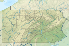
Catawissa Creek starts in Luzerne County, not far from Hazleton. It flows west and slightly south into Schuylkill County before flowing north into Columbia County and then west to the Susquehanna River, which it flows into at Catawissa. It parallels Catawissa Mountain for a significant portion of its course.
The surface rock in Catawissa Creek largely consists of sedimentary rock, such as sandstone and shale. However, there is also coal in the watershed. Major soils in the creek's watershed include the Leck Kill soil and the Albrights series. Most of the steeper hills in the watershed are situated near the headwaters of the creek.
Coal mining was once a major industry in the Catawissa Creek watershed, but this is no longer the case. Major tributaries of Catawissa Creek include Little Catawissa Creek and Tomhicken Creek. The president of the Catawissa Creek Watershed Restoration Association, Ed Wytovich, called Catawissa Creek "probably the most beautiful screwed-up stream east of the Mississippi".[2]
- ^ Thomas K. Donnalley, Larry S. Watson (editors) (1986), Handbook of Tribal Names of Pennsylvania: Together with Signification of Indian Words, p. 27, ISBN 9780942594119
{{citation}}:|author=has generic name (help) - ^ a b Ad Crable (July 26, 2006). "No longer dead in the water". Lancaster Online. Archived from the original on December 27, 2013. Retrieved November 14, 2013.
- ^ U.S. Geological Survey. National Hydrography Dataset high-resolution flowline data. The National Map Archived 2012-03-29 at the Wayback Machine, accessed August 8, 2011
- ^ Gertler, Edward. Keystone Canoeing, Seneca Press, 2004. ISBN 0-9749692-0-6
- ^ Cite error: The named reference
catawissacreekreportwas invoked but never defined (see the help page). - ^ Franklin L. Curry (2011). Clean Politics, Clean Streams: A Legislative Autobiography and Reflections. Rowman & Littlefield. p. 171. ISBN 9781611460735.
- ^ Remediating the Audenreid Mine Tunnel Discharge (PDF), Susquehanna River Basin Commission, January 2005, archived from the original (PDF) on October 29, 2013, retrieved October 24, 2013
- ^ John H. Brubaker (2002), Down the Susquehanna to the Chesapeake, Penn State Press, p. 73, ISBN 0271046651
© MMXXIII Rich X Search. We shall prevail. All rights reserved. Rich X Search

