Back مطار سنترفيل المحلى ARZ Centerville Municipal Airport (tugpahanan sa Tinipong Bansa, Iowa) CEB فرودگاه شهری سنترویل (ایووا) Persian Aeroportul Municipal Centerville Romanian Фурудгоҳи шаҳре снтруил (оюво) Tajik سینٹرویل میونسپل ہوائی اڈا (آئیووا) Urdu
Centerville Municipal Airport | |||||||||||
|---|---|---|---|---|---|---|---|---|---|---|---|
| Summary | |||||||||||
| Airport type | Public | ||||||||||
| Owner | City of Centerville | ||||||||||
| Serves | Centerville, Iowa | ||||||||||
| Elevation AMSL | 1,023 ft / 312 m | ||||||||||
| Coordinates | 40°41′04″N 092°54′04″W / 40.68444°N 92.90111°W | ||||||||||
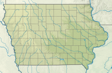
| Map | |||||||||||
| Runways | |||||||||||
| |||||||||||
| Statistics (2008) | |||||||||||
| |||||||||||
Centerville Municipal Airport (ICAO: KTVK, FAA LID: TVK) is a city-owned public-use airport located three nautical miles (6 km) southwest of the central business district of Centerville, a city in Appanoose County, Iowa, United States.[1] According to the FAA's National Plan of Integrated Airport Systems for 2009–2013, it is categorized as a general aviation airport.[2]
Although many U.S. airports use the same three-letter location identifier for the FAA and IATA, this airport is assigned TVK by the FAA and no designation from the IATA.[3]
- ^ a b FAA Airport Form 5010 for TVK PDF. Federal Aviation Administration. Effective 8 April 2010.
- ^ National Plan of Integrated Airport Systems for 2009–2013: Appendix A: Part 2 (PDF, 1.04 MB) Archived June 6, 2011, at the Wayback Machine. Federal Aviation Administration. Updated 15 October 2008.
- ^ "Centerville, Iowa - Centerville Municipal Airport (ICAO: KTVK, FAA: TVK)". Great Circle Mapper. Retrieved 24 May 2010.
© MMXXIII Rich X Search. We shall prevail. All rights reserved. Rich X Search

